How Much Does a Drone Topographic Survey Cost UK? (2026)
Drone topographic survey cost: from £800 for sites from 3 acres
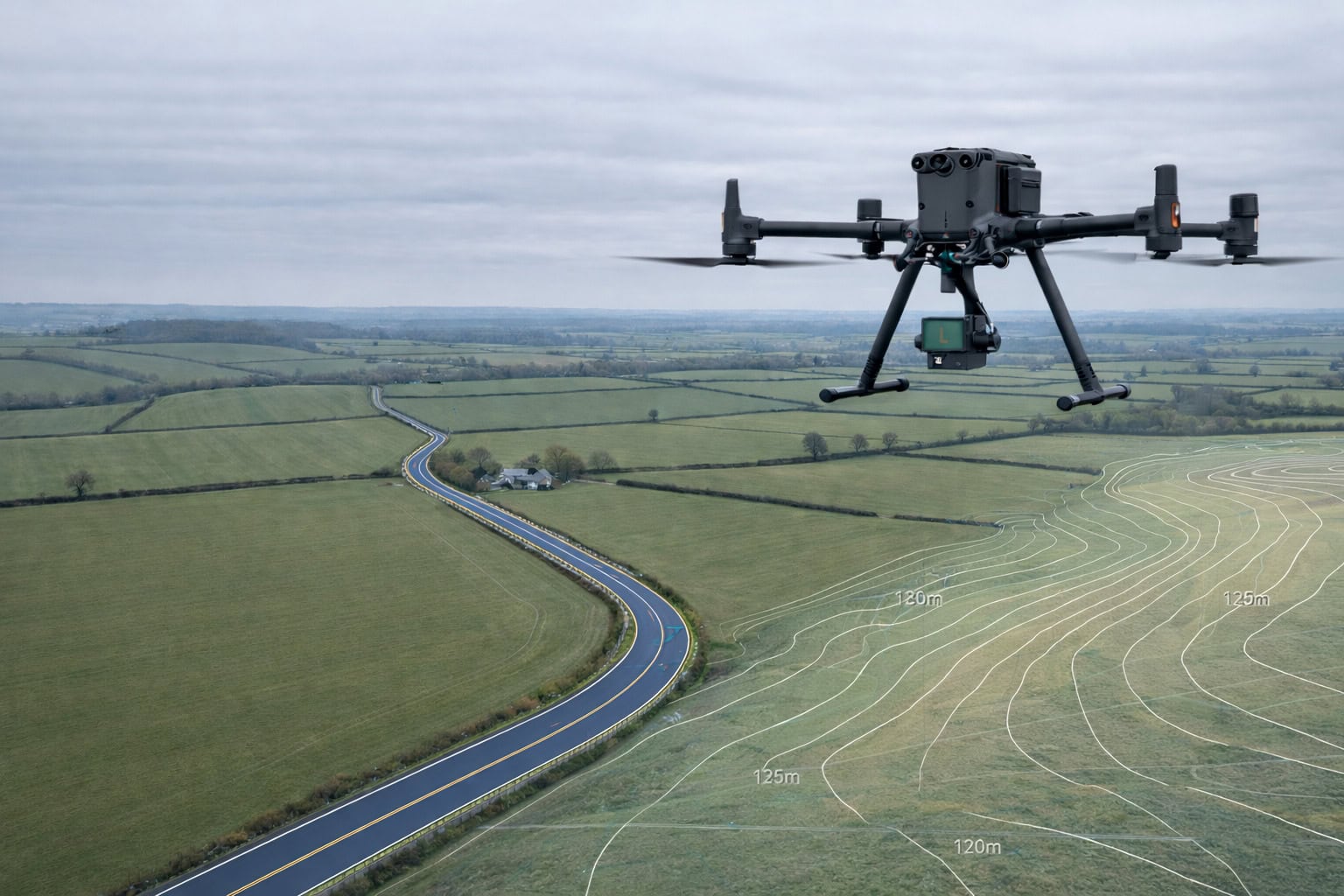
Sky Scan Surveys carries out topographic surveys using UAV photogrammetry. Our minimum viable site is 3 acres (1.2 ha) — below that, drone mobilisation costs make the method uneconomical. For sites of 3 acres and above, drone surveys deliver faster data capture, wider area coverage, and a comprehensive point cloud and orthomosaic that traditional ground-based methods cannot match at the same price point.
Typical drone topographic survey costs range from £800 for a 3–5 acre development site to £3,500+ for sites of 20 acres and above. Fixed quotes are issued within 24 hours.
Sky Scan carries out topographic surveys by drone for development sites of 3 acres (1.2 ha) and above — at this scale, drone mobilisation is faster and more cost-effective than a traditional ground crew.
For sites with dense tree canopy, drainage invert data requirements, or airspace restrictions, we’ll advise on the most suitable approach before any cost is committed.
Drone Topographic Survey Costs UK Quick Reference (2026)
| Site Size | Typical Cost | Notes |
|---|---|---|
| 3–5 acres (1.2–2 ha) | £799 – £1,499 | Entry-level development sites, smaller commercial parcels |
| 5–10 acres (2–4 ha) | £1,499 – £2,499 | Residential development plots, industrial land |
| 10–20 acres (4–8 ha) | £2,499 – £3,499 | Large development sites, infrastructure corridors |
| 20–50 acres (8–20 ha) | £3,499 – £5,499 | Masterplan sites, greenfield allocations |
| 50+ acres (20+ ha) | POA | Multi-phase programmes, large infrastructure projects |
| Ground Control Points (GCP enhancement) | +£399 – £599 | Improves accuracy to ±15–20 mm; required for engineering-grade work |
| Enhanced deliverables (point cloud, BIM, orthomosaic) | +£199 – £499 | In addition to standard 2D DWG output |
Prices are representative 2026 UK market rates. Fixed quotes issued within 24 hours of scope confirmation. Minimum site: 3 acres.
How Drone Topographic Survey Pricing Is Scoped
Sky Scan quotes are fixed prices built from four inputs: site area, accuracy requirements, deliverable specification, and mobilisation. Understanding how each one affects your budget prevents surprises on invoice.
Site Area
Area is the primary cost driver. UAV flight time, data processing, and CAD drafting all scale with site area — but not linearly. Mobilisation, travel, GCP setup, and CAD layer standards are fixed costs that stay the same whether the site is 3 acres or 10 acres. As a result, the cost-per-acre falls as site size increases.
A 3-acre site and a 6-acre site on the same day do not cost twice as much — the mobilisation, equipment setup, and CAD production overhead is the same. The difference is mainly extended flight time and additional processing. This is why larger sites offer better value per acre than smaller ones.
Sky Scan’s 3-acre minimum exists because below that threshold, the UAV setup and mobilisation costs consume most of the survey budget without delivering the scale advantage that makes drone surveys cost-competitive.
Accuracy and Ground Control
Standard drone photogrammetry without ground control achieves ±50 mm horizontal and vertical accuracy — sufficient for general planning applications and site design.
For projects requiring higher accuracy — engineering design, earthworks, drainage, or infrastructure — Ground Control Points (GCPs) bring accuracy to ±15–20 mm. GCP surveys add £400–600 to the base cost and typically add one additional site visit or extended on-site setup time.
Other surveyors often quote lower starting prices by omitting GCP setup. If your project will feed into engineering design or construction setting-out, confirm whether the quote includes ground control — accuracy without a documented GCP network is not verifiable.
Deliverable Specification
Standard deliverables included in all Sky Scan drone topo quotes:
All surveys include a CAD topographic surface model with levels and contours. Additional detail, engineering data, and accuracy upgrades can be added as required.
| Deliverable | Included as standard? | Add-on cost |
|---|---|---|
| 2D CAD surface (DWG/DXF), spot heights, contours | YES | — |
| Georeferenced drone orthomosaic (GeoTIFF) | YES | — |
| OSGB36 / BNG coordinate system + accuracy statement | YES | — |
| Ground Control Points (±15–20 mm accuracy) | Optional | +£149–£249 |
| 3D point cloud (survey model) | YES | — |
| BIM-ready surface model (IFC / Revit) | Optional | +£299–£499 |
| Feature survey (boundaries, structures, drainage covers, street furniture) | Optional | From £249 |
| Tree survey (locations, canopy spread, stem data) | Optional | +£249 |
| Breaklines (kerbs, walls, banks, grade changes) | Optional | +£149–£349 |
| Cross sections / profiles | Optional | +£199 |
| Drainage inverts (manhole surveys) | Optional | +£179 |
The orthomosaic is included as standard in all drone surveys — it is a by-product of the photogrammetry process and has no additional cost. Point clouds and BIM deliverables require additional processing time.
Site Conditions and Mobilisation
Factors that affect price beyond the standard scope:
Restricted airspace — CAA SORA or operational authorisation required for certain sites (near airports, heliports, congested areas). Sky Scan holds the necessary permissions; we confirm airspace classification at quote stage.
Dense canopy cover — Heavy tree cover limits photogrammetry (LiDAR recommended) accuracy for ground surface modelling. Leaf-off surveys (November to March) give better ground model penetration. Surveys under dense canopy may require supplementary ground-truthing.
Remote or difficult access — Sites over 2 hours from our operational base incur a mobilisation surcharge. Sites requiring overnight stays or specialist access vehicles are quoted individually.
Active construction sites — Working around live plant and materials restrictions typically adds coordination time and may require a phased flight plan.
Drone Topographic Survey Pricing by Project Type Four Scenarios
Housing Development Pre-Application (3–4 Acres)
Site: 3.2 acres (1.3 ha) residential land, greenfield, Yorkshire
Purpose: Developer needs topographic model for planning pre-application — architect requires base plan for layout design
Method: Drone photogrammetry, standard accuracy (no GCP)
Deliverable: 2D DWG at 1:500, contours at 0.5m, drone orthomosaic, feature survey
Fixed cost: £900 – £1,200
Turnaround: 1 day on site; drawings within 5 working days
At 3–4 acres on open greenfield land, this is the entry-level drone topo scope. Standard accuracy (±50 mm) is appropriate for pre-application layout design — engineers and architects can work to this tolerance for massing, drainage concept, and access routing. GCP upgrade (£400–600 additional) would be recommended if the site moves into detailed design.
Brownfield Redevelopment Site (4–5 Acres)
Site: 4.4 acres (1.8 ha) brownfield land, former industrial, Midlands
Purpose: Developer preparing planning application — requires accurate levels for drainage strategy and earthworks
Method: Drone photogrammetry with Ground Control Points (GCP)
Deliverable: 2D CAD at 1:500, 0.25m contours, georeferenced point cloud, orthomosaic
Fixed cost: £1,300 – £1,800
Turnaround: 1 day on site (flight + GCP setup); processed within 5 working days
The GCP package is included here because the drainage strategy and earthworks design require ±20 mm vertical accuracy. Without GCPs, the drone surface model on a brownfield site — with varying hard surfaces, former building footprints, and debris — will have localised errors that could compromise drainage design. The additional cost is significantly less than redesigning drainage after setting out.
Large Mixed-Use Development (10–15 Acres)
Site: 11 acres (4.5 ha) mixed-use development allocation, urban fringe, South East
Purpose: Design team requires full topographic model for planning submission and infrastructure design
Method: Drone photogrammetry with GCP, supplementary ground survey for boundary features and drainage inverts
Deliverable: Full 3D point cloud, 2D CAD at 1:500, drone orthomosaic, drainage invert schedule
Fixed cost: £2,800 – £3,500
Turnaround: 1–2 days on site; 7–10 working days processing
At this scale, the supplementary ground survey for drainage inverts and boundary detail is standard practice. The drone captures the surface model efficiently; the ground survey captures below-ground drainage reference points that photogrammetry cannot record. The combined approach is faster and cheaper than a traditional full-site ground survey, which at 11 acres would typically cost £5,000–£7,000+.
Greenfield Masterplan Site (25+ Acres)
Site: 28 acres (11.3 ha) greenfield agricultural land, mixed terrain, varied slope
Purpose: Masterplanner requires comprehensive topographic model for site-wide scheme design
Method: Drone survey with RTK-controlled GCPs; multi-flight programme over 2 days
Deliverable: Full 3D point cloud, 2D CAD at 1:1000, BIM-compatible surface model (IFC), drone orthomosaic
Fixed cost: £4,500 – £6,000
Turnaround: 2 days on site; 10–14 working days processing and BIM delivery
At this scale, a traditional ground-based survey would require a survey team of 3–4 over 4–5 days in the field, with significantly higher field costs. The drone survey with RTK GCPs covers the entire site in 2 days at sub-±20 mm accuracy across the whole area. The BIM surface model is structured for direct import into the design team’s Revit environment, eliminating conversion work at the design stage.
What Is and Is Not Included in the Price?
All Sky Scan drone topographic surveys include:
- Drone flight, data capture, and on-site operations (CAA-compliant)
- 2D CAD plan: DWG and PDF at specified scale
- Spot heights across the site at appropriate intervals
- Contour lines at 0.25 m, 0.5 m, or 1.0 m intervals (confirmed at quote)
- Feature survey: trees (position, crown spread), structures, boundary walls, drainage covers, kerbs, road markings, service markers
- Georeferenced orthomosaic (GeoTIFF) — included as standard
- Coordinate reference: OSGB36 National Grid, OS datum (ODN) vertical
- Accuracy statement documenting achieved tolerances
Typically NOT included unless specified:
- Ground Control Points / RTK ground control (£149–248 add-on)
- DWG/ BIM surface model (£549–749 add-on)
- Underground drainage CCTV or service mapping (specialist sub-contractor)
- Flood risk or hydrological modelling
- Measured building survey of existing structures on site
- Planning drawings, architectural design, or design interpretation
If your project requires a measured building survey of an existing structure alongside the topographic survey, Sky Scan provides both. Combining them in one site mobilisation reduces overall cost. See our topographic survey services page for a full breakdown of methodology, accuracy, and deliverable formats.
What to Have Ready When Requesting a Quote
To issue a fixed price within 24 hours, we need:
Site location
postcode or address (we check airspace classification and access constraints before quoting)
Site area
approximate acres or hectares; a rough estimate is fine
Purpose
planning pre-app, full planning, detailed design, earthworks, as-built, or other
Accuracy requirements
general planning (standard) or engineering/drainage/BIM (GCP upgrade required)
Deliverable requirements
2D DWG is standard; advise if point cloud, BIM, or orthomosaic are required
All quotes are fixed-price and valid for 30 days. We will ask follow-up questions if needed.
Drone Topographic Survey Cost FAQs
How much does a drone topographic survey cost for a development site?
For a development site of 3–5 acres, a drone topographic survey typically costs £800–£1,500 without ground control, or £1,300–£2,000 with GCP enhancement for engineering-grade accuracy. Sites of 5–20 acres typically cost £1,500–£3,500. Sites of 20+ acres are quoted individually. Sky Scan’s minimum site size is 3 acres — below that, drone mobilisation costs make the method uneconomical.
What is Sky Scan's minimum site size for a drone topographic survey?
Sky Scan’s minimum viable site is 3 acres (approximately 1.2 ha). Below that threshold, the fixed costs of drone mobilisation, flight setup, and GCP placement consume most of the survey budget without delivering the cost and coverage advantages that make drone surveys better value than alternative methods.
Why does Sky Scan use drones instead of traditional surveying?
Drone photogrammetry captures more data, faster, across a wider area than traditional total station or GNSS grid survey methods. On a 5-acre development site, a drone captures a full point cloud, georeferenced orthomosaic, and surface model in a single day’s flying. An equivalent traditional survey would take a 2-person team 3–4 days in the field and would not produce a point cloud or orthomosaic. For development sites of 3+ acres, drone surveys are faster, more data-rich, and more cost-effective.
What is the difference between a standard drone survey and a GCP survey?
A standard drone survey (without ground control) achieves approximately ±50 mm horizontal and vertical accuracy. This is appropriate for planning applications and early-stage design. A GCP survey uses physical ground control points — surveyed with GNSS — to tie the drone data to the national coordinate system, achieving ±15–20 mm accuracy. GCPs add £400–600 to the cost and are recommended for drainage design, earthworks, and any work that will feed into construction setting-out.
Do I need a topographic survey for a planning application?
Yes, in most cases. Local planning authorities require an existing site survey drawing as part of a full planning application. For development sites, a topographic survey is standard practice — it forms the base plan from which architects and engineers design the proposed scheme. A drone survey at ±50 mm accuracy is typically sufficient for planning. If the planning application includes a detailed drainage strategy or earthworks assessment, GCP accuracy (±15–20 mm) is advisable.
What is the difference between a topographic survey and a measured building survey?
A topographic survey records the external land — ground levels, contours, and above-ground site features. A measured building survey records the dimensions of existing structures — floor plans, sections, and elevations. If your project involves both land and an existing building, you need both surveys. Sky Scan provides both, and combining them at the same site mobilisation reduces cost.
How long does a drone topographic survey take from booking to delivery?
Most drone topographic surveys take 5–10 working days from booking to drawing delivery. The breakdown is: 1–3 days from booking to site (subject to weather and airspace clearance), 1–2 days on site for flight and GCP capture, 3–7 days for data processing and CAD production. Large sites or complex BIM deliverables extend processing time. Urgent turnaround is available for time-critical programmes.
Is VAT included in your topographic survey quotes?
All Sky Scan quotes are exclusive of VAT unless stated otherwise. VAT at the standard rate applies. Quotes are fixed-scope — no additional charges after acceptance unless scope changes at client request.
Get a Fixed Drone Topographic Survey Quote
Sky Scan provides fixed-price drone topographic survey quotes within 24 hours. No day-rate billing. No post-survey adjustments.
We operate across the UK. For sites of 3+ acres requiring a topographic model for planning, design, or construction, contact us with the site location, approximate area, and required deliverables.
All prices are representative 2026 UK market rates and are exclusive of VAT. Actual project cost confirmed at quote stage based on site area, accuracy requirements, and deliverable specification. Minimum site: 3 acres.