Introduction
If you’re planning a construction project, land subdivision or boundary demarcation in the UK, an accurate drone land survey is essential. UAV based land surveys capture high resolution topographic data, boundary information and elevation models in a fraction of the time required by traditional ground crews. With RTK (Real Time Kinematics) or PPK GNSS corrections and advanced sensors, drones routinely achieve centimetre level accuracy, all while keeping surveyors safely on the ground. In this guide you’ll learn what a topographic survey is, how drones conduct land surveys, the accuracy and equipment involved, the benefits over traditional methods, typical pricing and deliverables, and answers to frequently asked questions. By the end you’ll know why Sky Scan Surveys is the trusted partner for land surveying projects across the UK.
What Is a Topographic Survey?
A topographic survey is a detailed survey of the natural and man made features on a parcel of land. It records the position, elevation and geometry of features such as boundaries, trees, buildings, roads, utilities and earthworks. Topographic surveys are used for planning, design, construction, drainage analysis and legal documentation. Traditional methods rely on total stations and GPS rovers, which require surveyors to traverse the site on foot. Drone based topographic surveys capture the same data from the air, producing point clouds and digital terrain models that can be imported directly into CAD or BIM software.
How Drones Conduct Land Surveys
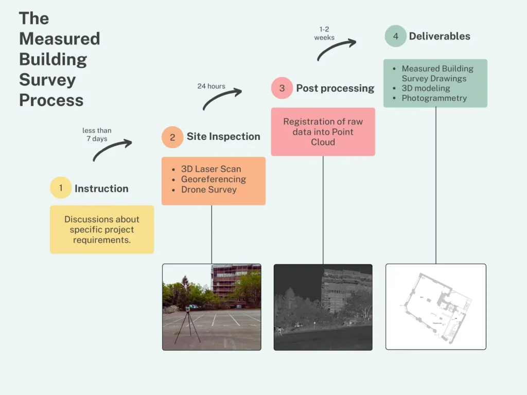
Mission Planning & Airspace Permissions
Every drone land survey begins with careful mission planning. The surveyor defines the site boundaries, identifies ground control points (GCPs) and checks airspace restrictions. In the UK, flights in congested areas or near airports require CAA approval. Sky Scan Surveys manages all risk assessments, prepares flight plans and secures necessary permissions.
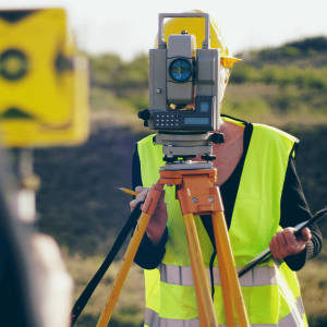
Ground Control & Reference Points
To achieve centimetre‑level accuracy, surveyors install GCPs across the site and record their coordinates using high‑precision GNSS equipment. These control points anchor the aerial data to true coordinates and correct any positional errors in the drone’s onboard GPS. Additional check points verify accuracy during post‑processing.
RTK/PPK GNSS and Autonomous Flight
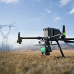
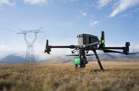
Modern survey drones use RTK (Real‑Time Kinematics) or PPK (Post‑Processed Kinematics) to correct positional data in real time or during post‑processing. The flight plan is uploaded to the drone, which follows a precise grid pattern at a fixed altitude, capturing overlapping images or LiDAR data. In practice, a single battery can cover tens of hectares (often up to 100 acres or more) before needing a change, making drones ideal for large land parcels.
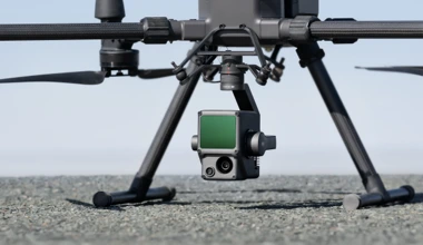
Sensor Payloads
Depending on the project requirements, drones can be equipped with:
- High‑resolution RGB cameras for photogrammetry, producing orthomosaics and detailed visual data.
- LiDAR sensors for penetrating vegetation and generating dense point clouds – useful for forestry and uneven terrain.
- Multispectral cameras for vegetation analysis and environmental monitoring.
Data Processing
After the flight, photogrammetry software stitches the overlapping images into a seamless orthomosaic. Using triangulation, the software creates a dense point cloud and generates digital surface models (DSM) and digital terrain models (DTM). LiDAR data are processed separately, producing point clouds that capture the ground surface and vegetation. The outputs are georeferenced using GCPs and exported to CAD/GIS formats for further analysis.
Accuracy & Equipment
Centimetre‑Level Accuracy
With RTK/PPK and properly placed GCPs, drone surveys achieve 2–3 cm horizontal and vertical accuracy. This level of precision meets or exceeds the requirements for most planning and engineering applications and aligns with guidelines published by the Royal Institution of Chartered Surveyors (RICS).
Equipment Overview
Sky Scan Surveys uses a fleet of professional‑grade drones, including quadcopters and fixed‑wing aircraft, equipped with:
- RTK GNSS modules for real‑time corrections.
- Survey‑grade cameras with 20–50 MP sensors and global shutters.
- LiDAR sensors delivering millions of points per second for dense point clouds.
- Redundant flight systems for safety and reliability.
Our ground station includes GNSS receivers, total stations for GCP measurement, and rugged laptops running industry‑standard photogrammetry software.
Benefits vs Traditional Surveys
Speed & Efficiency
Drone land surveys cover large areas in hours rather than days or weeks. Rapid data collection reduces labour costs and accelerates project timelines. Traditional surveys require crews to physically access every corner of a site, which is time‑consuming and sometimes hazardous.Cost Savings
Without the need for scaffolding, heavy equipment or multiple crew members, drone surveys offer significant cost savings. You save on mobilisation, labour and equipment hire while obtaining high‑quality data. Clients often find that the cost of a drone survey is offset by the savings in project delays and rework.Enhanced Safety
Surveyors remain safely on the ground, avoiding exposure to steep slopes, dense vegetation and construction hazards. Drones mitigate risks associated with working near traffic, waterways or unstable terrain.Comprehensive Data
Drones capture high‑density point clouds and imagery that provide more detail than sparse ground measurements. The resulting DSM/DTM and orthomosaics offer a complete picture of the site, identifying features that may be missed on foot. For legal boundary surveys, detailed aerial imagery helps verify encroachments and easements.Minimal Disruption
Drones operate quietly and quickly, causing little disturbance to land owners, businesses or wildlife. Surveys can be conducted without shutting down operations or restricting access to a site.Drone vs Traditional Surveys – Comparison
| Feature | Drone Land Survey | Traditional Ground Survey |
|---|---|---|
| Speed | Covers large areas in hours; data processing automated | Crews take days or weeks; manual measurements and logs |
| Coverage | Flies over inaccessible or hazardous terrain | Access limited by obstacles, slopes, vegetation |
| Accuracy | Centimetre-level accuracy with RTK/PPK and GCPs | High accuracy but relies on physical access and can miss details |
| Safety | Surveyors remain on the ground; reduced exposure to hazards | Surveyors work near traffic, heavy equipment or unstable ground |
| Cost | Lower mobilisation and labour costs; fewer site visits | Higher labour and equipment costs; extended site disruption |
| Data Density | Generates dense point clouds and high-resolution imagery | Provides discrete point measurements; less detail |
Get a Quote for Your UK Land Survey
If you’re ready to see how drone technology can streamline your land survey, reach out to our team for a bespoke quote. We’ll assess your site requirements and provide a clear proposal with costs, deliverables and timelines. Get a drone land survey quote today and start planning your project with confidence.Ready to unlock the power of drone surveying for your land project?
Click the “Get a Quote” button below or contact our survey team on to discuss your requirements. We’ll assess your site, advise on the best approach and provide a tailored proposal within 24 hours.
Get a QuotePricing & Deliverables
| Survey Size | Typical UK Cost | Deliverables |
|---|---|---|
| Small parcels (1–5 acres) | £550 – £1500 | Orthomosaic, DSM, contour map, boundary overlay |
| Medium sites (5–20 acres) | £1500 – £3500 | Orthomosaic, DSM/DTM, point cloud, volumetrics |
| Large areas (20–100 acres) | £3500 – £7000+ | DSM/DTM, LiDAR point cloud, 3-D mesh, breaklines |
- Terrain & vegetation – Dense forests require LiDAR; flat fields can be captured with photogrammetry.
- Accuracy – Higher accuracy targets require more GCPs and RTK/PPK corrections.
- Deliverables – Deliverables such as CAD drawings, BIM models or volumetric reports increase processing time.
- Permissions – Flights in congested areas or close to airports need additional planning and fees.
- Georeferenced orthomosaic with RGB imagery.
- DSM and DTM for elevation analysis.
- Point cloud (photogrammetric or LiDAR) for 3‑D modelling.
- Contour maps and breaklines for engineering design.
- Boundary overlays for legal documentation.
- Volumetric reports for cut‑fill calculations.
Frequently Asked Questions (FAQ)
How accurate are drone land surveys?
With RTK/PPK corrections and ground control points, drone land surveys achieve horizontal and vertical accuracy of 2–3 cm. This satisfies the requirements of most planning, engineering and legal applications.
Do I need permission to conduct a drone land survey?
Yes. Commercial drone operations in the UK must comply with Civil Aviation Authority (CAA) regulations. Sites in congested areas or near airports often require operational authorisation. Sky Scan Surveys handles all permissions and risk assessments.
What is the difference between RTK and PPK?
RTK (Real‑Time Kinematics) corrects positional data in real time during the flight by referencing a base station. PPK (Post‑Processed Kinematics) applies corrections after the flight during data processing. Both methods improve accuracy; RTK is faster but requires a live connection to a base station.
How long does a drone land survey take?
Surveys can usually be flown in a single day. Small sites (<5 acres) may take 1–2 hours, while larger sites require multiple flights. Processing and deliverable generation typically take 1–3 days, depending on data volume and output requirements.
What file formats will I receive?
Clients receive deliverables in standard formats such as GeoTIFF, LAS/LAZ, DXF, DWG and PDF. We can also provide 3‑D models compatible with CAD and BIM software.
Can drone surveys replace traditional boundary surveys?
Drone data enhance and accelerate boundary surveys, but final legal boundaries still require verification by a chartered surveyor using traditional methods. Drones provide context and help identify encroachments, but they do not replace legal boundary demarcation.
Why Choose Sky Scan Surveys?
- Experience & Accreditation – CAA‑approved, CITB SMSTS and SafeContractor certified. Our pilots and surveyors have decades of experience in land surveying and UAV operations.
- Cutting‑Edge Technology – We invest in the latest RTK drones, LiDAR sensors and photogrammetry software.
- Comprehensive Services – From roof inspections to full scan‑to‑BIM models, we provide end‑to‑end data solutions. Explore our specialist pages on Roof Inspections, Topographic Surveys, Volumetrics & Cut Fill and Scan‑to‑BIM to see how each service can support your project.
- Transparent Pricing – Bespoke quotes with clear breakdowns and no hidden fees.
- Nationwide Coverage – Regional teams across the UK enable rapid deployment and local expertise.
- Trusted Reputation – Hundreds of completed projects; testimonials and case studies available on our website.
- Client Testimonials – “Sky Scan saved us weeks of field work on our housing development in Manchester,” says James H., a construction project manager. “The drone data was accurate, the team were professional and the final deliverables integrated perfectly with our CAD software.” Testimonials like this showcase our commitment to quality and customer success.
Paul Harty
CAA certified drone pilot & surveyor .
At Sky Scan Surveys, we pride ourselves on being a team of CAA-certified commercial drone pilots with extensive training and experience in SURVEYING and post-processing aerial data. Our collective commitment is to deliver the highest quality services to our clients. We hold qualifications that ensure top-notch safety, professionalism, and accuracy in all of our work.