
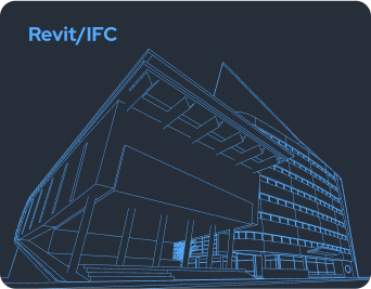
Scan-to-BIM (Point Cloud → Revit/IFC)
UK-wide capture → verified Revit/IFC at agreed LOD and tolerances.
Scan
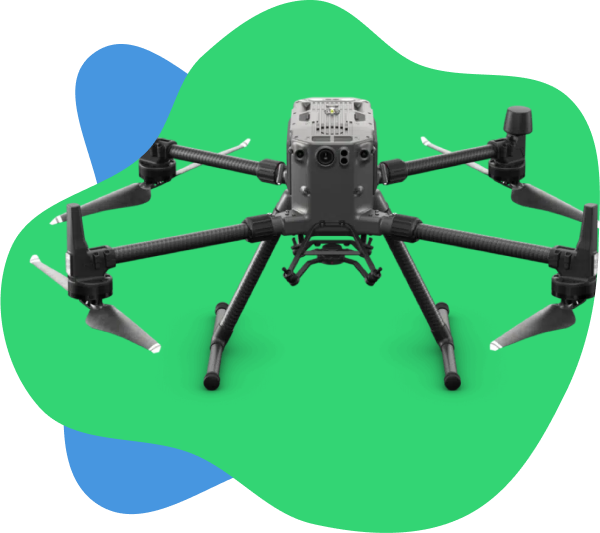
Capture precise site data using laser scanning and drone photogrammetry.
Model
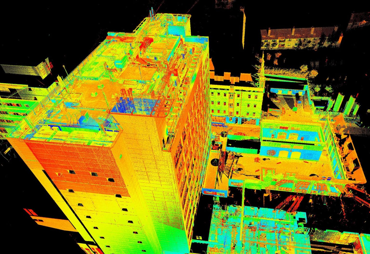
Convert point clouds into accurate BIM models at your specified LOD.
Deliver
Supply verified Revit, IFC, and CAD files ready for your workflow.
OSGB36/BNG
CAA CAP 722 Compliant
Measured to RICS Standards
LOD 200–400
Why Scan-to-BIM with SkyScan
Precision You Can Trust
Models up to LOD 400 with defined tolerances and QA checklist for full accuracy assurance.
Precision You Can Trust
Models up to LOD 400 with defined tolerances and QA checklist for full accuracy assurance.
Precision You Can Trust
Models up to LOD 400 with defined tolerances and QA checklist for full accuracy assurance.
Precision You Can Trust
Models up to LOD 400 with defined tolerances and QA checklist for full accuracy assurance.
Precision You Can Trust
Models up to LOD 400 with defined tolerances and QA checklist for full accuracy assurance.
Precision You Can Trust
Models up to LOD 400 with defined tolerances and QA checklist for full accuracy assurance.
From Scan to Model
Scoping & control
- Scope & brief. Confirm LOD targets (200-400), spaces in/out of scope, discipline split (arch/struct/MEP), and coordinate datum (OSGB36/BNG).
- Control & survey design. Establish RTK/total-station control (linked to OS Net or site grid) and set scan positions to achieve coverage and overlap.
Capture
- Interiors/structure (TLS). Static TLS at strategic stations; fine angular resolution in critical areas (stairs, plant, interfaces).
- Façades/roof (UAV). CAA CAP 722 compliant flight planning; nadir + oblique passes for GSD 5-15 mm/px; extra passes for glazed/complex geometry. (Related: drone roof inspections → /drone-roof-inspections/)
Processing & QA
- Registration & QA. Register scans (cloud-to-cloud & control); apply bundle adjustment; compute residuals versus control; issue residuals report.
- Point cloud hygiene. Classify/clean (remove noise/people/cars), decimate to target densities per zone, clip ceiling voids as agreed.
Modelling & handover
- Modelling. Revit families, system elements and profiles created to the agreed LOD; export IFC2x3/IFC4 as required.
- Model QA & audit. Run clash checks, tolerance spot-checks, level alignment, and naming standards; compile Audit & Issue Register.
- Deliverables & review. Supply RVT/IFC + DWG/DXF/PDF with a read-me covering versions, coordinates, and any limitations.
- Change support. Rapid revisions for design changes; additional model areas produced under the same control and QA.
Why Accuracy & Tolerances
Precision You Can Measure
Every project is captured and verified to RICS Measured Survey standards, with tolerances defined by capture method and model detail.
OSGB36 / BNG Control
RICS QA Verified
LOD 200–400
Context | Capture Method | Typical Tolerance | Notes |
|---|---|---|---|
Interiors / Structural |
TLS |
±3–5 mm |
Small rooms & stairs tighter; site conditions apply |
Façade / Roof |
UAV + TLS |
±5–25 mm |
GSD 5–15 mm/px; extra TLS control for edges |
Topographic Context |
UAV/TLS + RTK |
±10–35 mm |
RTK-controlled; ideal for massing & general design |
Services / MEP Centreline |
TLS |
±10–15 mm |
As-installed geometry; symbols for valves/tags |
Coordinate system: OSGB36 / BNG · LOD mapping: 200–400 · Glass/plant may need extra TLS. Source: RICS Measured Surveys (2023).
Project Deliverables & File Formats
Deliverable | Format(s) | Typical content | LOD coverage |
|---|---|---|---|
Revit model |
TLS |
Discipline-specific or combined model |
200/300/350 |
Open model |
IFC2x3/IFC4 |
Discipline-specific or combined model |
200/300/350 |
CAD drawings (DWG/DXF) |
WG/DXF/PDF |
Plans, sections, elevations; key dims |
200/300/350 |
Point cloud |
E57/LAS/LAZ/RCP |
Registered cloud (RGB/Intensity) |
[Assumption] |
Orthomosaic |
GeoTIFF (OSGB36/BNG) |
High-res plan of roof/façades |
[Assumption] |
Model Audit & Issue Register |
PDF/CSV |
Assumptions, occlusions, residuals, tolerance checks |
N/A |
QA pack |
PDF |
Control diagram, registration stats, residuals, versions |
N/A |
RAMS & flight logs (if UAV) |
PDF |
CAA CAP 722 compliance record |
N/A |
Pricing & Cost Factors
Scope | Typical size | LOD | Guide price | What drives cost |
|---|---|---|---|---|
Small unit / retail |
≤1,000 m² |
200-300 |
£2,500-£6,000 |
Access hours, occlusions, tight tolerances, sheet count |
Office (3-6 storeys) |
2,000-8,000 m² |
300-350 |
£6,000-£18,000 |
Stairs/cores, plant rooms, glazing, façade complexity |
Industrial shed |
3,000-15,000 m² |
200-300 |
£4,000-£12,000 |
Column grid accuracy, services density, eaves height |
Campus / mixed-use |
10,000 m²+ |
300-350 |
£18,000-£40,000+ |
Multi-building control, phased access, coordination |
Add-ons |
N/A |
N/A |
£350-£1,200 ea |
Orthomosaic, extra sheets, LOD 400 elements, urgent turnaround |
Note: Prices ex. VAT; subject to scope, access and LOD. Need survey control or context mapping? Consider a topographic survey →
Frequently Asked Questions
How much does Scan-to-BIM cost?
- Small units (≤1,000 m²) at LOD 200-300 typically £2,500-£6,000 ex. VAT; scope and access may vary this.
What versions of Revit/IFC do you support?
- We agree a Revit version at kick-off and can supply IFC2x3 or IFC4 for open workflows.
How do you guarantee accuracy?
- Through control-based registration, documented residuals, spot-checks and a RICS-aligned QA pack with stated tolerances per zone.
Will UAV imagery be legal on busy sites?
- Yes-where safe and legal. We follow CAA CAP 722, provide RAMS, and plan quiet windows or alternative TLS capture if UAV is constrained.
Can you model MEP in detail?
- Yes, to the agreed LOD. Typical as-installed centrelines are ±10-15 mm; valve/asset tags as symbols unless LOD 350-400 is specified.
Do you provide CAD drawings as well as models?
- Yes-CAD drawings (DWG/DXF) and PDFs are standard; layer conventions and title blocks are agreed at briefing.
Which coordinate system do you deliver in?
- OSGB36 / British National Grid (BNG) by default, with shared coordinates documented. Local or engineering grids can be added.
How long does capture take on site?
- Small units: 0.5-1.5 days; multi-storey offices: 1-3 days; campuses: by programme. Modelling time scales with LOD and sheet count.
Is PAS 128 included?
- PAS 128 (utility mapping) is optional and quoted separately; we integrate PAS 128 deliverables into the BIM model or sheet set when required.
What about reflective or transparent surfaces?
- We plan extra TLS/UAV passes and use cross-capture (angles/targets). Some glazing may need acceptance of best-fit geometry.
Can you stage the deliverables?
- Yes-point cloud early, then RVT/IFC by level/wing, followed by final sheets and QA pack.