
Topographic Surveys (OSGB36/BNG — RTK-Controlled)
High-fidelity mapping of existing ground and features for design, planning, and earthworks.
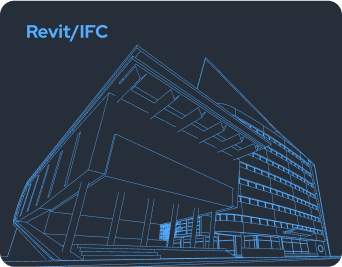
Deliverables include layered DWG/DXF, CSV spot levels, and a GeoTIFF basemap.
UK-wide RTK-controlled capture → design-ready outputs with verified accuracy.
Capture
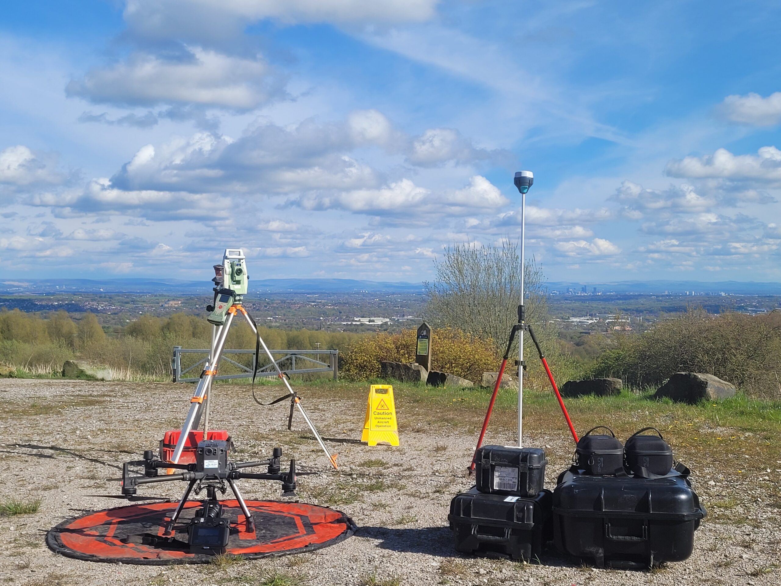
Capture ground, features, and levels using RTK GNSS, total station, and drone photogrammetry.
Model
Process data into coherent, layered DWG/DXF with levels, breaklines, and contours.
Deliver
Supply verified DWG, CSV, and GeoTIFF files ready for design, planning, and earthworks.

OSGB36 / BNG Control
RICS Measured Survey Aligned
Measured to RICS Standards
RTK / TS + Drone Capture
Why Topographic Surveys with SkyScan
Design-Ready Accuracy
Create consistent, georeferenced bases that reduce design clashes and rework across projects.
Reliable Ground Models
Generate accurate terrain and surface data for volume checks, haul planning, and progress tracking.
Planning & Coordination
Detailed feature mapping accelerates approvals and supports utilities coordination for design teams.
Controlled & Repeatable Workflow
Every survey follows an RTK-controlled workflow with documented tolerances and QA evidence.
Scalable for Any Site
Efficient data capture using total station, GNSS, and drones — from small plots to multi-hectare sites.
Compliance & QA
RICS Measured Survey alignment, defined control strategies, and full acceptance check reporting.
From Field to File
Control & Brief
- Establish OSGB36/BNG control and agree project scope — extents, features, and deliverables.
- Confirm accuracy targets and drawing requirements (DWG/DXF, CSV, GeoTIFF).
Ground Capture
- Use RTK GNSS and total station for features and breaklines.
- Add drone photogrammetry for continuous surface areas where suited.
Processing
- Register and merge datasets; generate surface triangles, contours, and breaklines.
- Validate topology and ensure layer consistency.
QA & Validation
- Compare check shots to control and report residuals.
- Document acceptance criteria within QA report.
Deliver & Handover
- Supply layered DWG/DXF, CSV spot levels, and GeoTIFF basemap.
- Optional LAS/LAZ point data and versioned deliverables with sheet index.
Accuracy You Can Measure
Accuracy You Can Measure
Each topographic survey is controlled to OSGB36/BNG and verified under RICS Measured Survey standards.
Tolerances are reported and validated against field control for full traceability.
OSGB36 / BNG Control
RTK / Total Station QA Verified
±10–20 mm Typical Accuracy
Feature | Output | Typical tolerance | Notes |
|---|---|---|---|
Planimetric features |
DWG/DXF |
±10–20 mm |
TS/RTK control; breaklines at hard edges |
Levels (spot) |
CSV/DWG |
±10–20 mm |
Dependent on surface & access |
Contours |
DWG |
0.2 m interval |
General design; tighter on request |
Geo-referencing |
OSGB36/BNG |
— |
UK Grid, metres |
Coordinate system: OSGB36 / BNG · Planimetric ±10–20 mm · Levels ±10–20 mm · Contours typically at 0.2 m intervals · Subject to site conditions and agreed control.
Project Deliverables & File Formats
Deliverables are structured for direct use in CAD, GIS, and design workflows. All outputs include metadata, control references, and QA verification.
File/Format | Purpose |
|---|---|
DWG/DXF (layered) |
Design base with features, levels and boundaries |
CSV (points/levels) |
Import to CAD/earthworks packages |
GeoTIFF orthomosaic |
Visual basemap for context |
Contours (DWG) |
0.2 m intervals; design and planning |
LAS/LAZ (optional) |
Point data for specialist analysis |
Pricing & Cost Factors
Pricing depends on site size, feature density, vegetation or occlusion, access constraints, and whether drone capture is included.
Fixed quotes define acceptance criteria and deliverables before fieldwork.
Note: Prices exclude VAT; subject to access and safety constraints.
Scope | Typical size | LOD | Guide price | What drives cost |
|---|---|---|---|---|
Small unit / retail |
≤1,000 m² |
200-300 |
£2,500-£6,000 |
Access hours, occlusions, tight tolerances, sheet count |
Office (3-6 storeys) |
2,000-8,000 m² |
300-350 |
£6,000-£18,000 |
Stairs/cores, plant rooms, glazing, façade complexity |
Industrial shed |
3,000-15,000 m² |
200-300 |
£4,000-£12,000 |
Column grid accuracy, services density, eaves height |
Campus / mixed-use |
10,000 m²+ |
300-350 |
£18,000-£40,000+ |
Multi-building control, phased access, coordination |
Add-ons |
N/A |
N/A |
£350-£1,200 ea |
Orthomosaic, extra sheets, LOD 400 elements, urgent turnaround |
Note: Prices exclude VAT; subject to site access and safety constraints.
Frequently Asked Questions
Which coordinate system do you supply?
OSGB36 / British National Grid with metres and a clear drawing origin.
Can you provide 0.2 m contours?
Yes—generated from controlled surface models where appropriate.
How are utilities handled?
We map visible apparatus and integrate provided utility records; PAS128 surveys can be
coordinated if required.
Do you include QA evidence?
Yes—control, residuals and acceptance checks are reported in the QA pack.
What formats do designers receive?
Layered DWG/DXF plus CSV levels and a GeoTIFF basemap.