
Bolton · Historic buildings · Aerial survey and CAD modelling
Aerial surveys for Bolton Town Hall and Museum refurbishment
Refurbishment design needs a clear record of the building already there. We surveyed Bolton Town Hall and Bolton Museum and Central Library, supplying roof drawings, elevations and digital models for the design team. The work recorded visible building geometry for design development. A year later, the team requested continued access to both online models so its appointed contractor could review the exteriors.
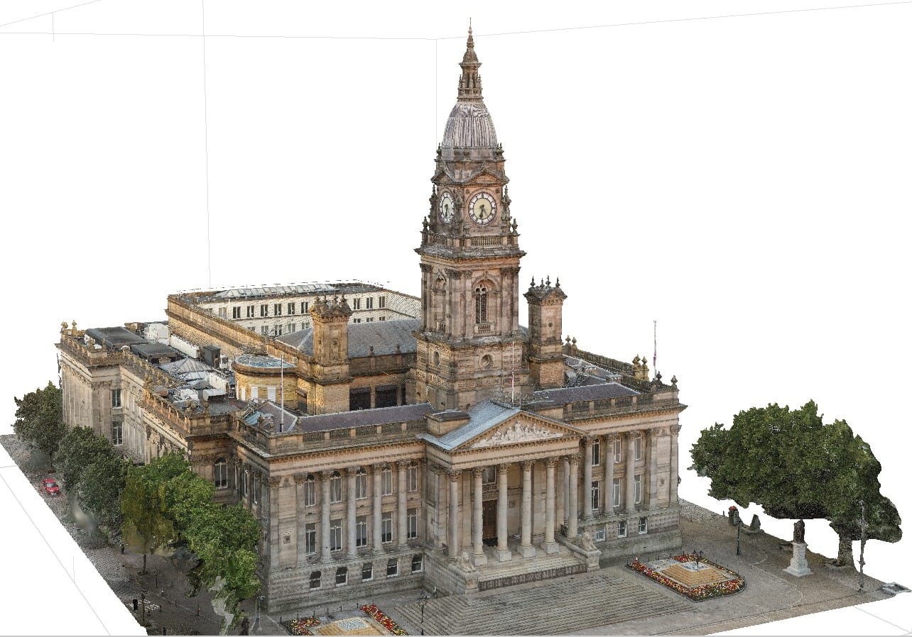
Bolton Town Hall: the textured survey model shows the roof forms, clock tower and external building surfaces.
Location
Bolton, Greater Manchester
Buildings
Town Hall; Museum and Central Library
Survey commission
2025
Purpose
Existing-building information for refurbishment design
01 / Client need
Understand the existing roofs before developing the design
The design team needed building information it could work with: roof shapes and levels, elevation drawings and models suitable for its design software. Photographs provided a visual record, while drawings and models organised the surveyed geometry for design work.
The commission covered two different buildings. Bolton Town Hall required its own roof and elevation package. The Museum and Central Library needed roof information to support redesign, including the relationship between rooflights, ridges, valleys, parapets and gutters.
Our contribution was the survey and modelling work. It gave the team a record of the visible building surfaces; it was not a structural assessment or a diagnosis of concealed roof construction.
02 / Bolton Town Hall
Roof drawings and models for a complex civic building
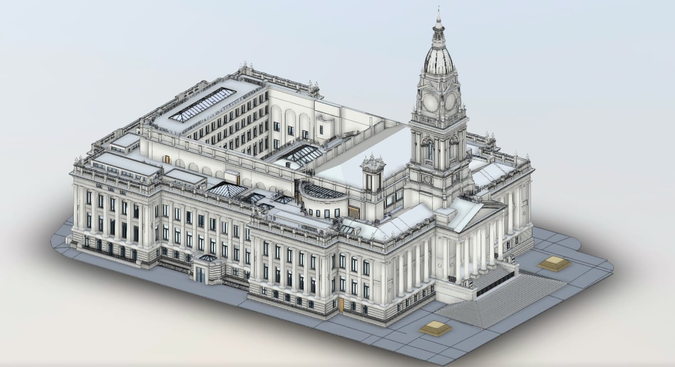
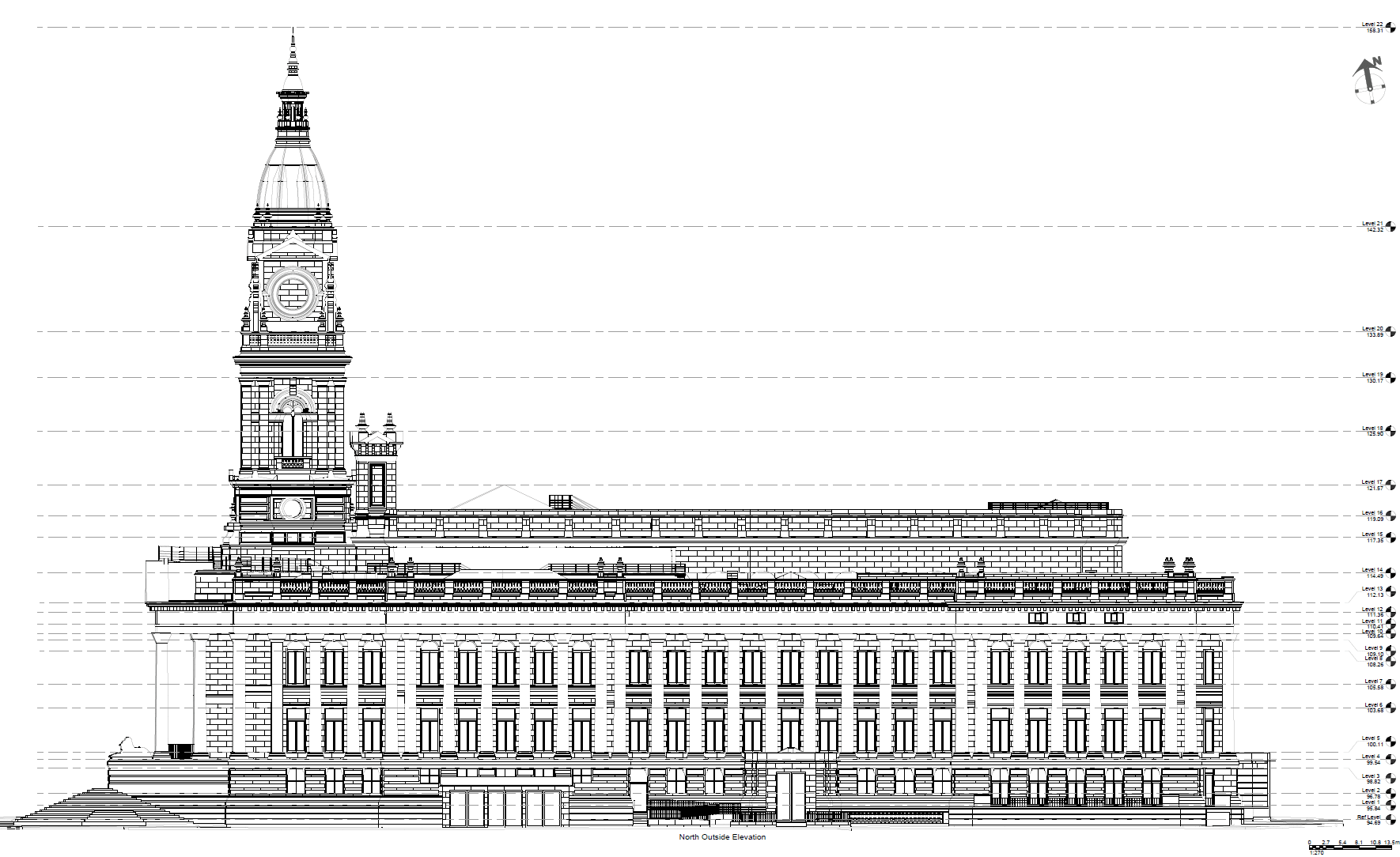
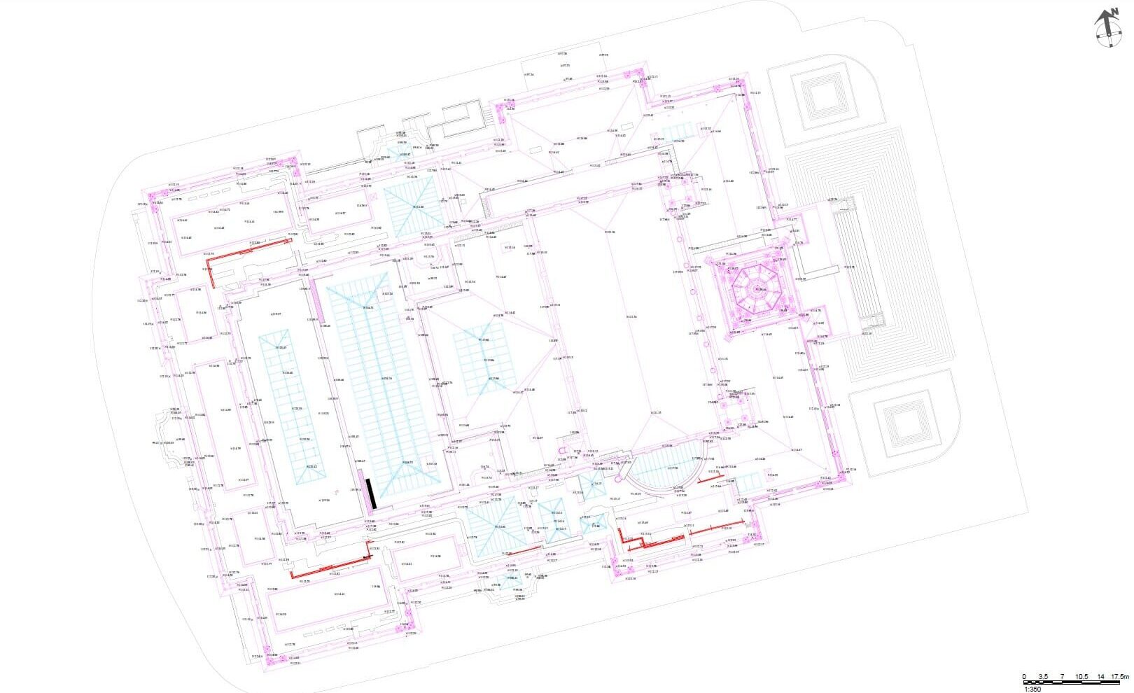
We prepared a separate drawing and model package for the Town Hall. The handover issued on 9 October 2025 listed a CAD roof plan, elevation drawings and Revit and IFC models for the design team.
These outputs served different tasks. A roof plan shows the layout from above. Elevations describe the building faces and their geometry. A three-dimensional model lets designers examine how those parts relate to one another, instead of relying on separate photographs.
Keeping the Town Hall package separate from the Museum information meant the team could work with the relevant building files while managing both within the same commission.
03 / Bolton Museum and Central Library
Roof information for the Museum redesign
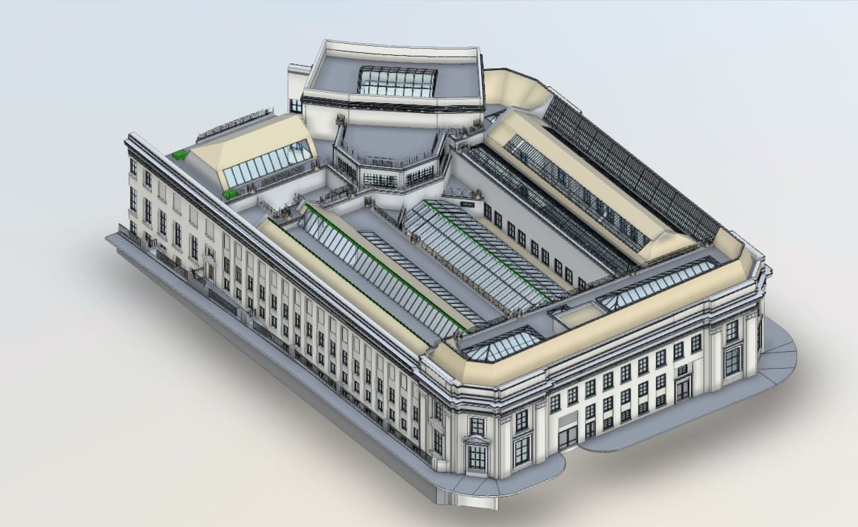
The Museum and Central Library needed a clear record of its roof for redesign. Our September 2025 survey captured the roof shapes, levels and long runs of rooflights. We supplied CAD drawings and a Revit model so the design team could work with that geometry.
04 / Deliverables
Files that fit the design team's next task
CAD roof plans and elevations
DWG files supplied editable drawing information, with PDF versions for review. The roof plans and elevations let the team work with the surveyed layout and levels without having to interpret the whole three-dimensional dataset each time.
Revit and IFC models
Building models supplied the surveyed geometry in formats used for design coordination. They represented existing building form; the proposed refurbishment design remained the design team’s work.
Photographic context and survey points
The Museum’s orthomosaic showed where visible roof features sat in relation to one another. Its E57 and LAZ point-cloud files retained the three-dimensional survey points alongside the drawing and model outputs.
Checks and scope
The Museum records use British National Grid coordinates and Ordnance Datum Newlyn heights. These provide a stated position and height reference. Visible geometry does not reveal concealed construction or certify structural condition. Dimensions critical to fabrication or installation need checks appropriate to that task.
05 / Continued use
The models were requested again for contractor review
In September 2026, the project team requested another year of access to both online models. An appointed contractor needed to review the exteriors, so the request extended beyond the original design-stage handover.
This is the recorded follow-up to the survey: the team wanted the models available for contractor review. It does not establish that construction was completed or that the survey produced a particular saving.
06 / Project questions
Planning a survey for a historic-building refurbishment?
What can an aerial survey provide for refurbishment design?
This commission supplied roof plans, elevation drawings and building models for two historic buildings. The Museum package also included an overhead photographic map and survey points. The right combination depends on what the design team needs to draw, measure or review.
How do photographs become a CAD or Revit model?
Photogrammetry uses overlapping photographs to reconstruct visible surfaces in three dimensions. Survey data then provides a basis for drawing and modelling those surfaces. The resulting CAD or Revit model is a representation prepared for an agreed purpose, rather than a photograph automatically turned into a complete building design.
Can contractors use the model after the design stage?
They can use it to review the recorded building, provided its coverage, survey date and detail suit the task. For this project, the team requested continued access to both online models after appointing a contractor. Any subsequent changes to the building still need to be considered.
Does a roof survey show everything beneath the roof covering?
No. The aerial survey records visible surfaces. Hidden construction, leaks and structural condition may require other inspections. Agreeing those boundaries helps the design team commission the right information.