Drone Land Surveying | Fast Accurate Cost Effective
Expert Drone Land Surveying Services for Accurate, Cost-Effective Solutions
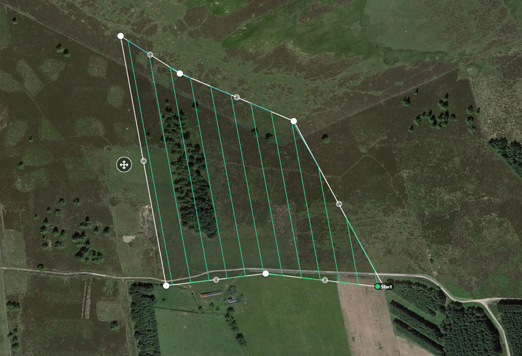
Sky Scan Surveys is the UK’s leading provider of drone land surveying services, delivering advanced aerial mapping solutions for diverse industries. From construction mapping and agricultural surveys to infrastructure inspections, our experienced team utilizes state-of-the-art drone technology to capture precise, reliable data. We provide actionable insights that optimize project workflows, saving you both time and money. Trust Sky Scan Surveys for high-quality, efficient, and cost-effective drone land surveys that elevate your projects to the next level.
Drone land surveys | mapping, modelling & management
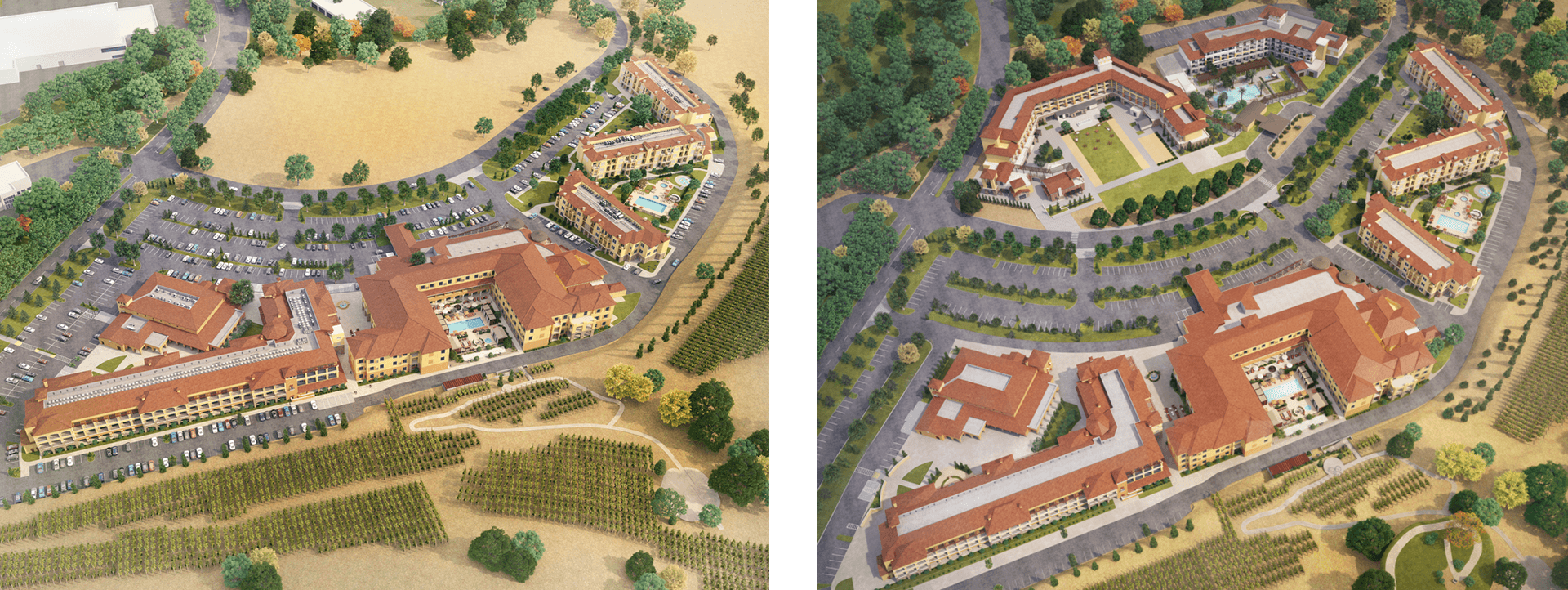
Our drones capture high-resolution images that are seamlessly stitched into precise 3D models of your site. These models are invaluable for construction planning, land development, and site analysis, offering a true-to-life representation of your project area.
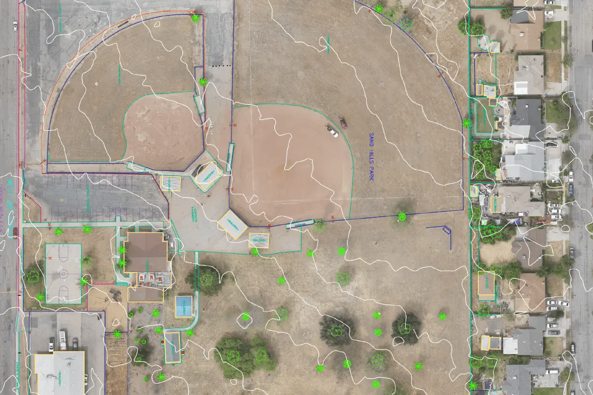
We produce orthomosaic maps with high-resolution, georeferenced aerial imagery. These maps are essential for land surveying, topographic mapping, and property boundary identification, providing the accuracy needed for effective planning and informed decision-making.
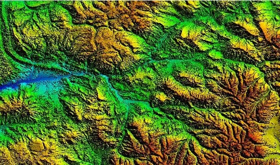
Our digital elevation models (DEMs) provide an accurate representation of the terrain, allowing for the evaluation of elevation changes, slopes, and land features. DEMs are critical for applications like flood risk analysis, construction design, and environmental monitoring.
Why Choose Sky Scan Surveys for Drone Land Surveying?
Fast and Efficient Data Collection
Our drones can cover vast areas quickly and accurately. Unlike traditional surveying methods that can take days, our drones can map hundreds of acres in just hours, delivering processed data in a matter of days.
Highly Accurate Results
We use advanced drones equipped with high-resolution cameras and sensors, ensuring that the data collected is highly accurate. Our team of certified drone pilots and data specialists processes the data with precision, creating deliverables such as georeferenced orthomosaics, 3D models, and volumetric calculations.
Cost-Effective Solutions
Drone mapping significantly reduces the need for expensive ground equipment and manual labor. By using drones, we can cut costs while delivering better results in less time.
Access to Hard-to-Reach Areas
Drones can easily reach areas that are difficult or dangerous for humans to access, such as steep slopes, large construction sites, or areas with limited space. This makes drone mapping ideal for a wide range of industries.
Real-Time Data
Our drones capture real-time data, allowing you to make informed decisions quickly. Whether you need land surveys, crop monitoring, or construction progress updates, our services provide up-to-date information that helps keep your project on track.
Get Started Today
We’re here to answer your questions and explore how our services can benefit your project. Don’t hesitate to reach out to us via phone, email, or through our social media channels.
Drone Land Surveying - What is it?
Drone land surveying utilizes UAVs (Unmanned Aerial Vehicles) to capture high-resolution imagery for precise mapping and analysis. This data is processed using advanced photogrammetry software to create orthomosaic maps, 3D models, topographic maps, and digital elevation models (DEMs).
Drone land surveying is gaining popularity for its speed, accuracy, and cost-effectiveness over traditional methods. It is especially valuable for construction site monitoring, land surveying, agricultural analysis, and infrastructure inspections, providing real-time, high-precision data essential for informed decision-making and project success.
Construction and Infrastructure
- Construction Site Surveys: Quickly gather topographic data for site planning and design.
- Progress Monitoring: Track the progress of construction projects with real-time aerial footage.
- Volumetric Measurements: Accurately measure materials and earthworks for better project management.
Agriculture
- Crop Monitoring: Create NDVI maps to track the health of your crops and make informed decisions about irrigation and fertilization.
- Field Mapping: Identify areas of improvement and optimize field use with aerial mapping.
- Yield Estimation: Estimate crop yields and make better decisions about harvesting and land use.
Environmental Monitoring
- Topographic Surveys: Assess environmental features and plan conservation efforts with precise data.
- Flood Risk Mapping: Identify flood risks using digital elevation models to assist in urban planning.
- Wildlife Tracking: Monitor natural habitats and assess the impact of development projects.
Mining and Quarrying
- Stockpile Measurements: Accurately calculate the volume of material in stockpiles to optimize inventory management.
- Site Planning: Create detailed 3D models of mining sites for better resource management and planning.
- Safety Inspections: Inspect hazardous areas with drones, reducing the need for manual, risky inspections.
Features
Competitive Pricing
3D Mapping
Accurate Results
Advanced Technology
Fast and Reliable
Enhanced Safety
Real-Time Data
Access to Hard-to-Reach Areas
How Drone Land Surveying Work
The process of our drone land surveying is efficient and straightforward:


