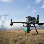
Drones are transforming how we capture accurate site data. From roof inspections to topographic mapping and building information modelling (BIM), a drone survey can deliver centimetre‑level detail quickly and safely. But how much does a drone survey cost? The answer depends on several factors, including the type of survey, the size and complexity of the site, the deliverables required and the technology used. This guide breaks down those variables and offers typical price ranges for common survey types. We also answer frequently asked questions and show you how to budget for your project.
Factors Affecting Cost
Prices vary between providers, and the figures below are guidelines only. They assume a CAA‑approved operator, full insurance and standard deliverables such as georeferenced orthomosaics, point clouds and basic CAD outputs. All prices are exclusive of VAT.
| Survey Type | Example Scope | Typical Price Range |
|---|---|---|
| Roof Survey (residential) | 1–2 storey house or small commercial roof, photogrammetry, 2D orthomosaic and defect report | £300–£600 |
| Roof Survey (commercial/industrial) | Large factory or warehouse roof up to 5,000 m², photogrammetry with optional thermal imaging, 2D/3D deliverables | £600–£1,200 |
| Land Survey – Small site | 1–5 acres (0.4–2 ha) of open land or building site, RTK photogrammetry, orthomosaic and point cloud | £750–£1,200 |
| Land Survey – Medium site | 5–20 acres (2–8 ha) of farmland, quarry or infrastructure, RTK photogrammetry, high resolution point cloud, contours and volume calculations | £1,500–£3,000 |
| Land Survey – Large/complex site | 20–100+ acres (8–40 ha) requiring multiple flights, LiDAR and ground control points for dense vegetation, detailed 3D model and volumetrics | From £3,000 (price on application) |
| Measured Building / BIM Survey | Internal and external capture of a house or small commercial building, 3D point cloud and CAD/BIM outputs | £1,500–£3,000 |
| Measured Building – Large structure | Multi storey or heritage building requiring internal LiDAR or backpack scanner, high accuracy BIM model | £3,000–£6,000+ |
| Drone Thermal Survey | Inspection of PV arrays, roofs or electrical equipment using thermal camera, delivery of thermographic analysis | £500–£1,500 |
These ranges are based on current market conditions and can fluctuate with inflation and demand. Always request a detailed quote for your specific project to get an accurate cost.
How to Budget for a Drone Survey
Whether you’re planning a one‑off roof inspection or a series of land surveys over several phases, budgeting upfront helps prevent surprises later. Here are some steps to consider:
Define your objectives and outputs – Are you looking for a simple visual inspection, accurate topographic data or a full BIM model? Make a list of required deliverables (orthomosaic, contours, CAD drawings, Revit model, volumetrics) and share it with your survey provider. The more detail you provide, the more accurate your quote will be.
Gather multiple quotes – Prices can vary between providers. Compare quotes not only on cost but also on the level of service, equipment used, accuracy specs and deliverables included. Ask to see sample data sets or case studies. Reviewing pages on our website, such as our Roof Survey service or Scan‑to‑BIM service, can help you evaluate the quality and scope of deliverables.
Consider site readiness – Clear vegetation, remove loose debris from roofs, inform neighbours and secure permissions. A well‑prepared site reduces flight time and lowers risk, which can help keep costs down.
Plan for weather contingencies – Weather affects flight safety and data quality. Build contingency days into your project timeline and budget for potential rescheduling, especially during the winter months.
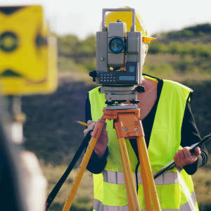
Check qualifications and insurance – Ensure the operator holds CAA operational authorisation, has adequate public liability insurance and follows health‑and‑safety protocols. Cheaper quotes may cut corners on compliance – don’t compromise on safety or legality. For an overview of UK drone regulations, see the Civil Aviation Authority’s guidance.
Ask about data ownership – Clarify whether you retain full rights to the data and models delivered. Confirm that raw files (e.g. point clouds, imagery) will be provided if you need them for future work.
Budget for post‑processing – Creating clean, georeferenced data ready for CAD or GIS takes time. Ask if data processing is included in the quote, and whether there are additional charges for editing, annotations or extra deliverables.
Think long term – If you’re planning multiple surveys (e.g. monitoring construction progress), you may benefit from a package deal or retainer. Regular surveys can reduce per‑survey costs and ensure you have consistent data for comparison.
Following these steps will give you a realistic sense of total project cost and help you avoid unexpected expenses.
Ready to plan your aerial survey? Use our quote request form to discuss your requirements.
Get a QuoteFAQs
How much does a drone survey cost in the UK?
Simple roof inspections typically start around £300–£500. A small land survey (1–5 acres) costs roughly £750–£1,200, while a medium site (5–20 acres) may be £1,500–£3,000. Complex sites or surveys requiring LiDAR or BIM modelling can exceed £3,000. Always request a tailored quote based on your project’s scope.
Why are drone surveys cheaper than traditional surveys?
Drones capture data much faster than manual methods, reduce the need for scaffolding or cherry pickers and minimise labour hours. They also deliver dense datasets that improve accuracy and reduce the likelihood of return visits. However, complex processing and specialist sensors (e.g. LiDAR, thermal) can raise the price.
Are drone surveys accurate?
Yes. When performed by qualified pilots using RTK/PPK drones and ground control points, drone surveys can achieve 2–3 cm absolute accuracy and sub‑centimetre relative accuracy. LiDAR payloads can penetrate vegetation for more reliable ground elevation data. Always ask your provider to state their expected accuracy and deliverables.
Do I need permission for a drone survey?
Operators must comply with the UK Civil Aviation Authority (CAA) regulations and obtain permission to fly in controlled airspace or close to uninvolved people. Visit the CAA’s drone regulations page for more details. As a client, you should secure access permissions for private land and inform neighbours. Your survey provider will handle flight plans, risk assessments and any necessary clearances.
How long does it take to receive the results?
Data capture usually takes 1–3 hours for a roof or small site and up to a day for larger surveys. Processing and generating deliverables can take 2–5 working days depending on complexity and the number of outputs. Thermal and LiDAR data may require additional time for calibration and analysis.
What’s included in the price?
A typical quotation covers pre‑flight planning, on‑site data capture by CAA‑approved pilots, insurance, processing of imagery into orthomosaics and point clouds, basic CAD or GIS outputs and a report of findings. Additional services such as ground control point surveying, advanced CAD drafting, BIM modelling or expedited delivery may incur extra charges.
Are there any hidden costs?
Transparent providers will itemise all costs. However, potential extras include travel expenses, additional site visits due to weather delays, extended data processing for complex deliverables and licensing of specialist software. Ask your provider to clarify any potential charges before starting.
Conclusion & Next Steps
Drone surveys offer a fast, safe and cost‑effective way to collect high‑quality spatial data for roofs, land and buildings. The price you pay reflects the scope of your project – factors like site size, complexity, required deliverables and sensor technology all play a role. For most residential roof surveys you can expect to pay a few hundred pounds, while medium‑sized land surveys generally cost £1,500–£3,000. Complex or large‑scale projects that require LiDAR, thermal imaging or BIM modelling will cost more.
To receive an accurate quotation tailored to your project, reach out to a reputable survey provider. At Your Company Name, our CAA‑approved pilots and surveyors deliver accurate data with quick turnaround times. Use our drone survey cost calculator or contact us for a custom quote. We’ll discuss your requirements, advise on the best survey method and provide a transparent, no‑obligation proposal.
Paul Harty
CAA certified drone pilot & surveyor .
At Sky Scan Surveys, we pride ourselves on being a team of CAA-certified commercial drone pilots with extensive training and experience in SURVEYING and post-processing aerial data. Our collective commitment is to deliver the highest quality services to our clients. We hold qualifications that ensure top-notch safety, professionalism, and accuracy in all of our work.