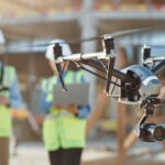

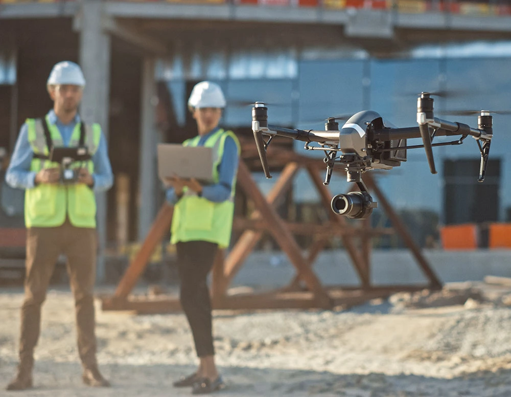
Thinking of hiring a drone for a land survey, roof inspection, or construction mapping project? You’re not alone — demand for drone surveying in the UK has skyrocketed in recent years. But how much does a drone survey actually cost in 2025? And more importantly, how can you get the best value?
This complete guide answers exactly that, breaking down current pricing, key factors that affect cost, and expert tips to save money — whether you’re surveying a property in Manchester, inspecting a roof in Bristol, or mapping a construction site in London.
📍 What Is a Drone Survey?
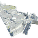
A drone survey uses unmanned aerial vehicles (UAVs) equipped with cameras, sensors, or LiDAR to collect data from above. This can include:
- Orthomosaic maps (2D stitched aerial imagery)
- 3D terrain models and point clouds
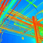
- Thermal imaging (great for leak detection or insulation analysis)
- Roof inspections (safe and quick for hard-to-reach areas)
- Progress tracking on construction sites
Compared to traditional surveying, drones deliver faster results, lower costs, and improved safety — often without the need for scaffolding or access ladders.
💰 What Affects Drone Survey Cost in the UK?
The cost of a drone survey can vary significantly depending on the scope and complexity of your project. Here’s what affects the price:
1. Survey Type & Required Data
- Roof Inspection: Cheaper due to small area and quick flight time.
- Land or Topographic Surveys: More expensive as they cover larger areas and require higher accuracy.
- Thermal or LiDAR Surveys: Typically the most expensive due to specialist sensors and data processing. LiDAR surveys often cost 20–40% more due to equipment and processing time.
2. Property Size and Complexity
- Larger or more complex structures mean more flight time and data processing.
- Urban areas with obstacles (chimneys, scaffolding) or dense terrain increase flight planning.
3. Equipment Used
- Standard photogrammetry is more affordable.
- RTK drones (real-time kinematic) improve accuracy but increase costs.
- LiDAR or thermal sensors can add 20–60% to base pricing.
4. Post-Processing Requirements
- Raw image capture is cheaper.
- 3D modelling, CAD-ready outputs, or annotated reports will raise costs due to technician time.
5. Operator Expertise & Insurance
- CAA-certified operators (GVC, A2 CofC) command higher fees but offer safety, compliance, and better deliverables.
6. Site Conditions & Accessibility
- Projects near airports or restricted airspace need extra permissions (£300–£600).
- Remote sites may incur travel surcharges (£50–£150).
- Rush delivery can add 25–50% to the cost.
- Booking off-peak or allowing flexible deadlines reduces pricing.
📊 Average Drone Survey Costs UK (2025)
Here’s what UK clients typically pay for drone survey services in 2025:| Service Type | Cost Range | What’s Included |
|---|---|---|
| Roof Inspection | £150 – £500 | High-res images, 20–60 min flight, PDF report |
| Drone Land Survey | £450 – £1,200+ | Photogrammetry, 2D orthomosaic, basic point cloud |
| LiDAR Survey | £1,000 – £3,000+ | Dense point cloud, terrain mapping, CAD-ready output |
| Thermal Drone Survey | £350 – £950 | Heat‐loss detection, moisture mapping, thermal imagery |
| Construction Progress | £400 – £1,000+ | Before/after images, timeline visuals, drone video |
| Roof + Thermal Combo | £500 – £900 | High-res + thermal scan, ideal for industrial sites |
⚠️ Hidden Costs to Watch For
Be aware of extra costs that may appear later:
- Travel/Call-Out Fees: Especially for rural or hard-to-reach locations.
- CAA Flight Permissions: Near airports or restricted zones.
- 3D Modelling Add-Ons: Point cloud exports, DWG or BIM file formats.
- Multiple Revisions: Extra edits or changes to deliverables.
Tip: Always ask what’s included in the quote — and what’s not.
💡 7 Smart Ways to Save Money on Drone Surveys
Here’s how savvy clients save hundreds without compromising quality:
- Bundle Services – Combine roof, land, and thermal surveys.
- Schedule Off-Peak – Winter or mid-week bookings often come discounted.
- Use Local Providers – Avoid travel costs.
- Minimise Extras — Only request 3D models if needed.
- Share Deliverables across departments (roofing, insurance, architects).
- Provide Clear Briefs — Scope creep means added cost.
- Ask for Reuse — Some areas can be surveyed and reused in future site plans.
📐 Drone Survey vs Traditional Methods: UK Cost Comparison
While other methods exist, drone surveying offers unique advantages for various UK projects, particularly when speed, safety, and comprehensive data are paramount.| Method | Avg Cost (10 ha) | Time | Accuracy | Pros | Cons |
|---|---|---|---|---|---|
| Drone Survey | £150 – £1,500 | 1–2 days | ±1–5 cm | Fast, safe, detailed, low disruption | Needs clear weather, limited at night |
| Manual Survey | £500 – £2,500+ | 1–2 weeks | ±1 cm | Familiar method, human eyes on site | Risky, time-consuming, more expensive |
| Scaffolding Setup | £900 – £1,800 | Setup + manual | Close-up detail | Allows close access | High setup time and insurance costs |
| Helicopter Survey | £3,000+ | Varies | Large area | Wide coverage | Very high cost and complexity |
👨✈️ When to DIY vs Hire a Drone Professional
| DIY | Hire a Pro |
|---|---|
| Simple site photos for personal use | Commercial work requiring accuracy |
| You’re a licensed drone pilot | Complex or high-risk environments |
| Basic aerial imagery for marketing | Thermal, LiDAR, or CAD deliverables |
📍 Real UK Drone Survey Examples
- Manchester: A £1,200 land survey for a housing development helped secure planning permission faster by delivering high-accuracy maps.
- Leeds: A £350 thermal inspection detected energy loss in a Victorian terrace, leading to major efficiency upgrades.
- Bristol: A £480 roof survey uncovered £15,000 in hidden water ingress damage — without scaffolding or shutdowns.
❓ Frequently Asked Questions (FAQ)
Q: How much does a drone roof survey cost in the UK?
Q: Are drone surveys cheaper than traditional surveys?
Q: What’s the cost per hectare for drone land surveys?
Q: How long does a drone survey take?
Q: What files will I receive from a drone survey?
Q: Are drone surveys accurate enough for planning applications?
📍 UK-Wide Drone Surveying Coverage
We operate across the UK, including:
- Greater London
- Manchester
- Leeds & Yorkshire
- Birmingham
- Bristol & the South West
- Glasgow & Edinburgh
Looking for a local drone survey? Request a free quote—fast turnaround, fixed pricing, and licensed pilots.
✅ Ready to Get Started?
Whether you’re surveying a building, inspecting a roof, or mapping a future development—our drone experts will help you save time, cut costs, and make smarter decisions.
Request a drone survey quote now →