Hello drone enthusiasts! It’s great to have you on the channel. I’m Paul. Today we’re delving into the world of starting a career in drone surveying. With 17 years in construction under my belt I made the switch to drone surveying about 3 4 years ago. Let me tell you its been a journey so far. In this article I’ll walk you through everything you need to kickstart your journey as a drone surveyor from selecting the drone to software and training essentials.
Lets dive in!
1. Selecting the Perfect Drone
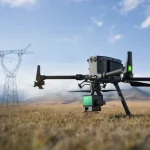
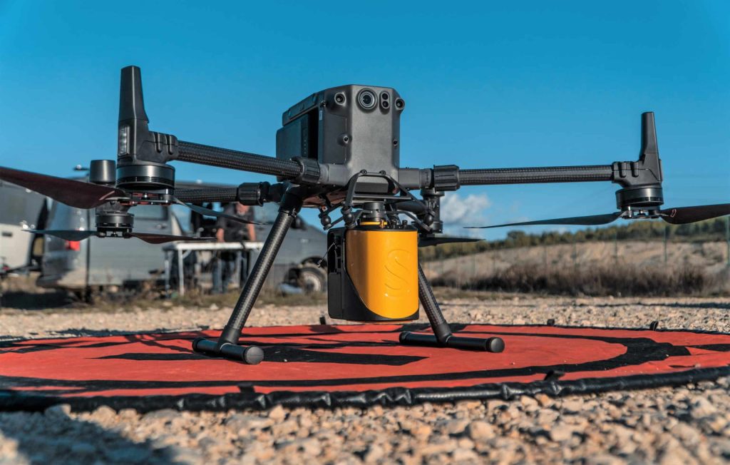
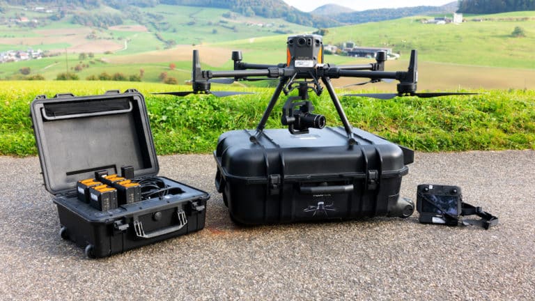
The initial step in launching your drone surveying venture is choosing the drone. My current favorite is the DJI Matrice 300 RTK. This model represents an upgrade from my DJI Phantom 4 RTK. The Matrice 300 RTK stands out for its durability, versatility and superior precision – qualities that’re essential for survey work.
Unlike versions, the DJI Matrice 300 RTK offers improved flight stability, longer flight durations and compatibility with payloads such as high resolution cameras and LIDAR systems. The Time Kinematic (RTK) feature ensures GPS data acquisition critical, for producing accurate surveys.
1. GPS Licensing and Connectivity:
After acquiring your drone the next step is obtaining a GPS license. If you’re coming from a background, in surveying you may already possess a GPS license that can be utilized. Otherwise there are companies offering short term licenses, which’s convenient if you don’t fly your drone on a daily basis. For your GPS requirements I suggest looking into PQS Tech for RTK licenses. They provide options tailored to your projects duration whether its for a day or an extended period.
2. Training and Certification:
To operate a drone legally for purposes obtaining the necessary accreditation is crucial. In the UK for example completing either the A2 CofC (A2 Certificate of Competency) or GVC (General Visual Line of Sight Certificate) courses is mandatory based on your drone type and intended operations. Many companies offer training programs, which can be advantageous. These programs offer experience with your drone while ensuring knowledge of all regulations and best practices. This hands on approach can save time. Ensure readiness for certification exams.
3. Insurance:
Insurance plays a role, in drone surveying. Is often underestimated. It’s essential to have coverage that safeguards both your drone and covers public liability risks.
I rely on Coverdrone for my insurance requirements. They provide options, such, as weekly coverage and also offer insurance for additional equipment like GPS units.
When it comes to processing and analyzing data after capturing it powerful software is essential. Initially I used the DJI app. Found it somewhat limiting. Nowadays I prefer using DroneDeploy for both planning flights and processing data. It operates on the cloud allowing you to process datasets without requiring a high spec computer.
Other software choices include Pix4D and Site Scan. While they come with features I stick with DroneDeploy because of its user interface and strong processing capabilities.
Don’t overlook the accessories for your drone operations
- Extra Batteries: Ensure you have power for surveys.
- Takeoff Pads and Cones: Mark out your takeoff and landing areas.
- Spare Cables: These are vital in case any of your cables fail.
- Memory Cards: capacity, reliable memory cards are crucial to store all the data you capture.
To explore more about the costs and options for our surveying services reach out to Sky Scan Surveys for a solution customized to your budget and survey requirements. Our dedication to delivering notch, practical and innovative services guarantees that we cater to the needs of each project.
Drones are transforming construction progress monitoring for quantity surveyors by providing real-time data, accurate site measurements, and better project insights, making tracking faster and more efficient.
For analysis and creating drawings consider using software, like LSS or AutoCAD.
LSS works wonders for handling point clouds and photogrammetry while AutoCAD is great, for putting the finishing touches on designs. Although both tools may come with a price tag they are essential for achieving top notch results.
Key Tips to Kickstart Your Journey
- Market Your Services: Utilize platforms such as LinkedIn to exhibit your portfolio and draw in clients.
- Know the Airspace Regulations: Familiarize yourself with all flight restrictions in place before commencing any project.
- Establish Fair Pricing: Make sure your pricing strategy reflects the value of your equipment, software and time investment.
- Clarify Deliverables: Clearly outline the services you will offer to clients, including any costs for data hosting.
There you have it! I trust this guide will set you on the path for venturing into drone surveying. Should you have any queries feel free to drop them in the comments section. Remember to hit subscribe and, like the video if you want tips and insights. Happy flying!