
Woodhall Spa · Golf course LiDAR · September 2026
Woodhall Spa Golf Course LiDAR Survey for Digital Recreation
Woodhall Spa is home to England Golf and the National Golf Centre. We surveyed its Bracken and Hotchkin courses for a digital course-building team. They needed the shape of the ground and matching aerial imagery to recreate the courses in Unreal Engine. We supplied separate terrain, image and ground-point packages for both courses.
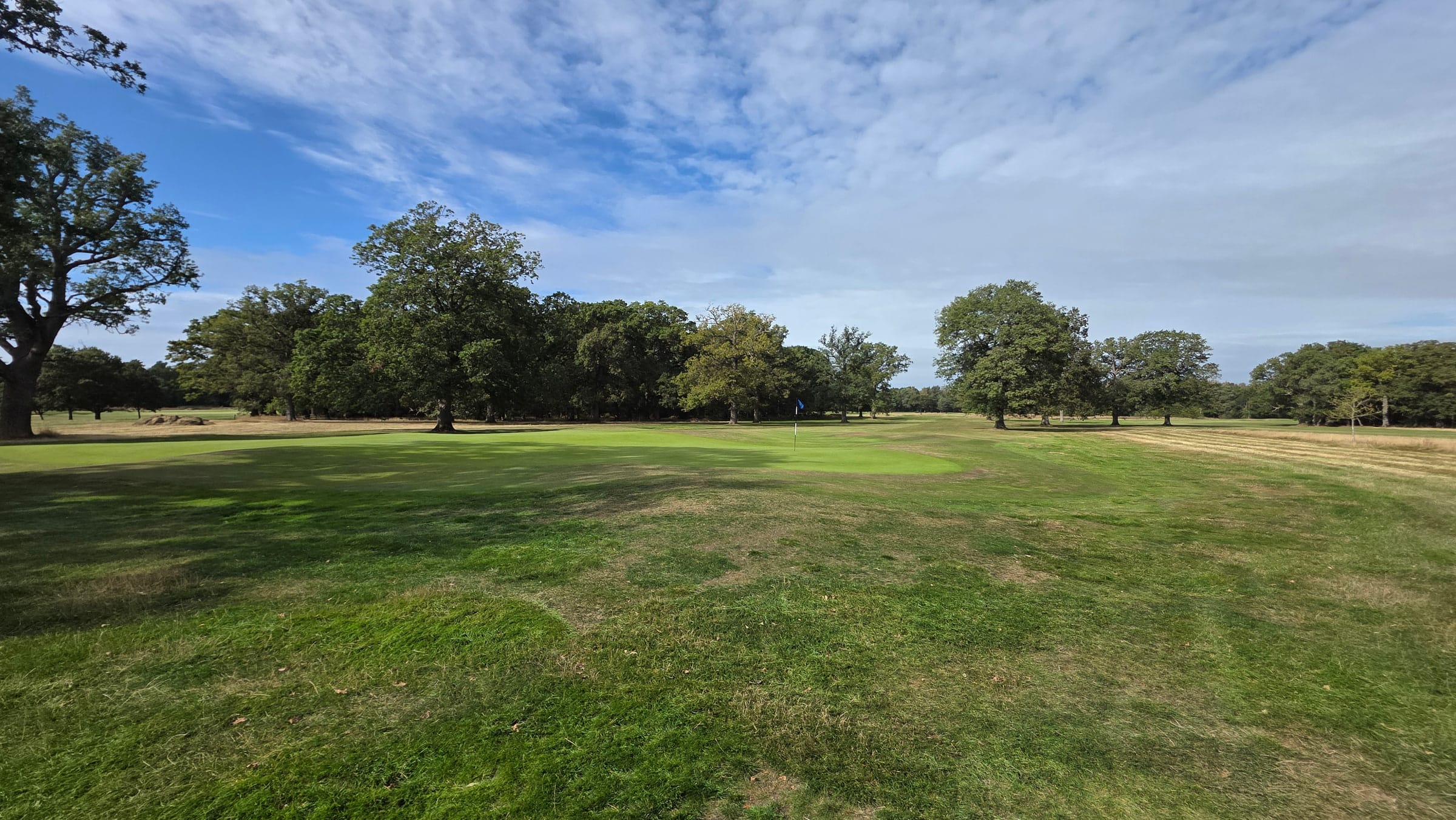
The visible course is only part of the story. Digital recreation also needs the ground heights that define its slopes and contours.
Location
Woodhall Spa, Lincolnshire
Courses
Bracken and Hotchkin
Method
Drone LiDAR and aerial imagery
Handover
28 September 2026
01 / Client need
Recreating the ground, not just the view
To recreate a golf course, the modeller needs both its appearance and its shape. Aerial imagery identifies greens, bunkers and paths; terrain data supplies their ground heights.
The client specifically requested a bare-earth digital terrain model, or DTM. A surface model that included the tops of trees would not meet that requirement: those heights must not become the playing surface in a digital course.
Before capture, we agreed the file formats and coordinate reference with the receiving modeller, whose workflow converted the terrain into an Unreal Engine heightmap.
Aerial imagery
Ground relief
Contours
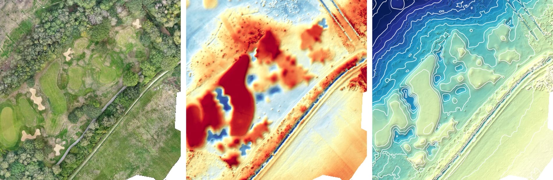
The same course detail in three views: visible features, ground shape and lines joining equal heights. Select the image for full-size detail.
02 / Survey approach
Connecting measured terrain with aerial imagery
We used drone LiDAR to record three-dimensional points and aerial photography to capture the courses’ visible features. LiDAR can record ground through gaps in vegetation, making it useful on courses with tree cover. It does not measure every point beneath dense canopy.
During processing, we classified the points to separate ground observations from trees and other above-ground features. The ground points formed the basis of each course’s terrain model. The photographs were combined into a positioned overhead map, called an orthomosaic.
The terrain, imagery and ground-point files shared British National Grid coordinates and Ordnance Datum Newlyn heights. This common reference connected what the modeller could see in the image with where it sat in the terrain. Bracken and Hotchkin stayed in separate packages so the receiving team could work with each course individually.
Working around vegetation and gaps
Where dense canopy or water left no usable ground observations, the terrain model estimated the surface between surrounding measurements. The survey reports identify these limitations. Separating measured ground from estimated areas matters when deciding how much detail to carry into a digital model.
03 / Deliverables
Two course packages, with three complementary outputs
The completed upload contained separate Bracken and Hotchkin folders, totalling 25.7 GB. Each included a survey report, a bare-earth terrain model, an aerial photographic map and ground-classified point-cloud files.
Ground-height models
Each course received a GeoTIFF terrain file with 5 cm cells. The file stores ground heights that the receiving team could convert into its required heightmap. Cell size describes the model’s spacing; it is not a 5 cm accuracy guarantee.
Aerial maps to identify course features
The orthomosaics show greens, bunkers, paths and vegetation in their surveyed positions. They give the modeller a photographic reference alongside the height data. Delivered pixel sizes were approximately 2.0 cm for Bracken and 1.7 cm for Hotchkin.
Ground points for further processing
Ground-classified LAZ files retained the individual three-dimensional survey points. Bracken was divided into 20 tiles and Hotchkin into 14. These files let the receiving team inspect or process the ground observations as well as use the supplied terrain grids.
Bracken: the image and the ground beneath it
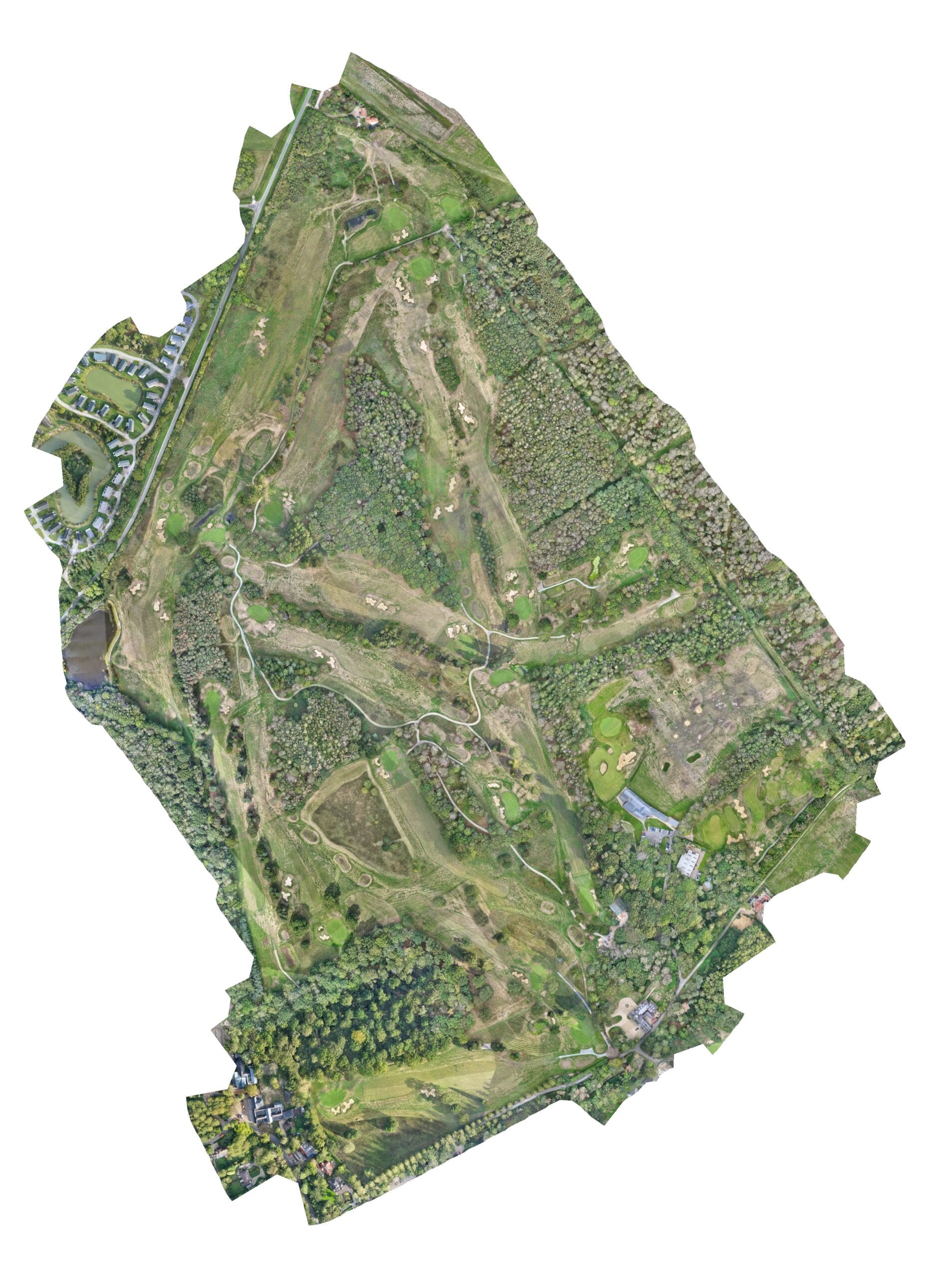
Bracken: the overhead photographic map supplied with the terrain data.
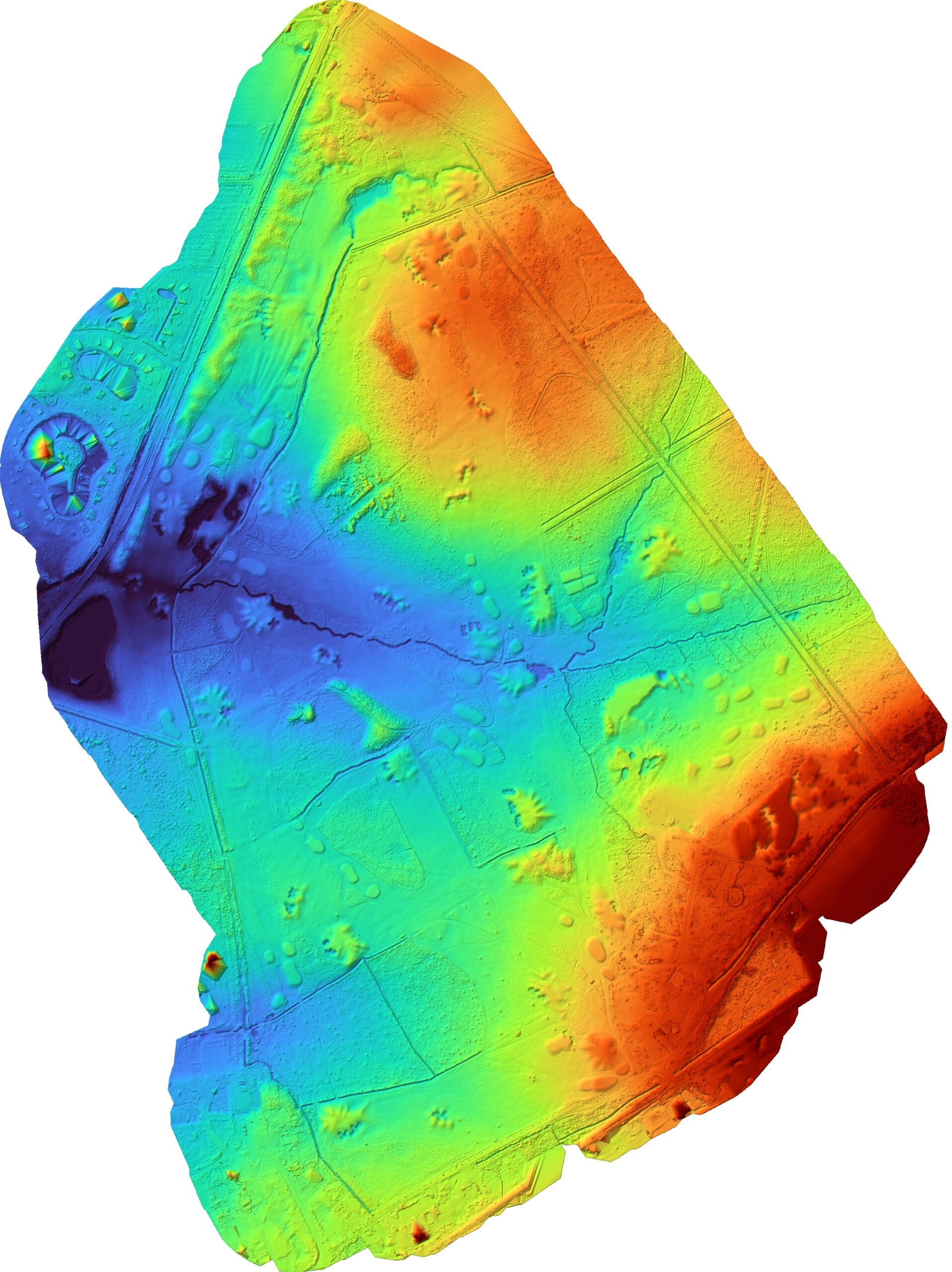
Bracken: an elevation view of the supplied terrain model.
Hotchkin: the same reference across both outputs
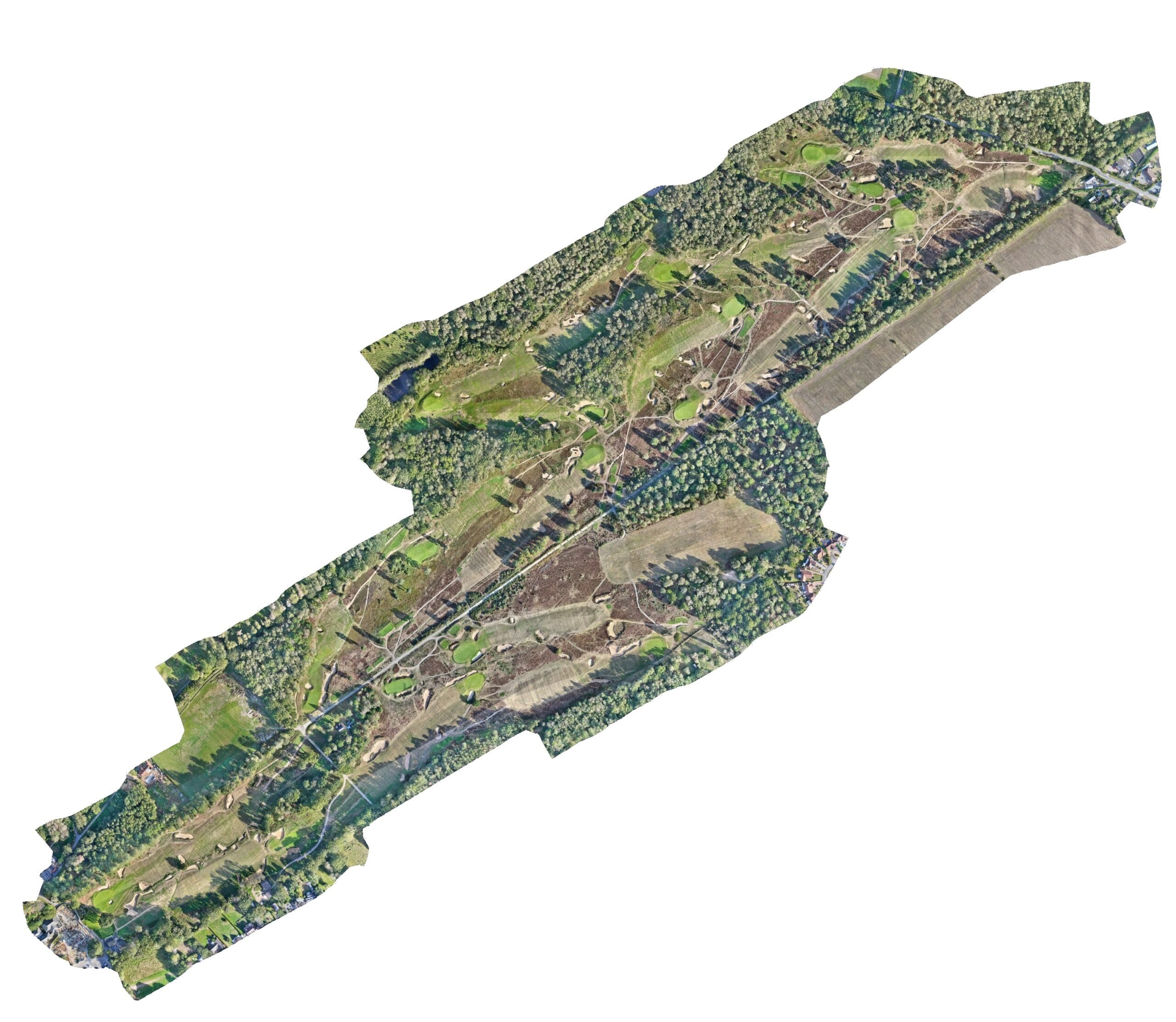
Hotchkin: matching imagery for identifying visible course features.
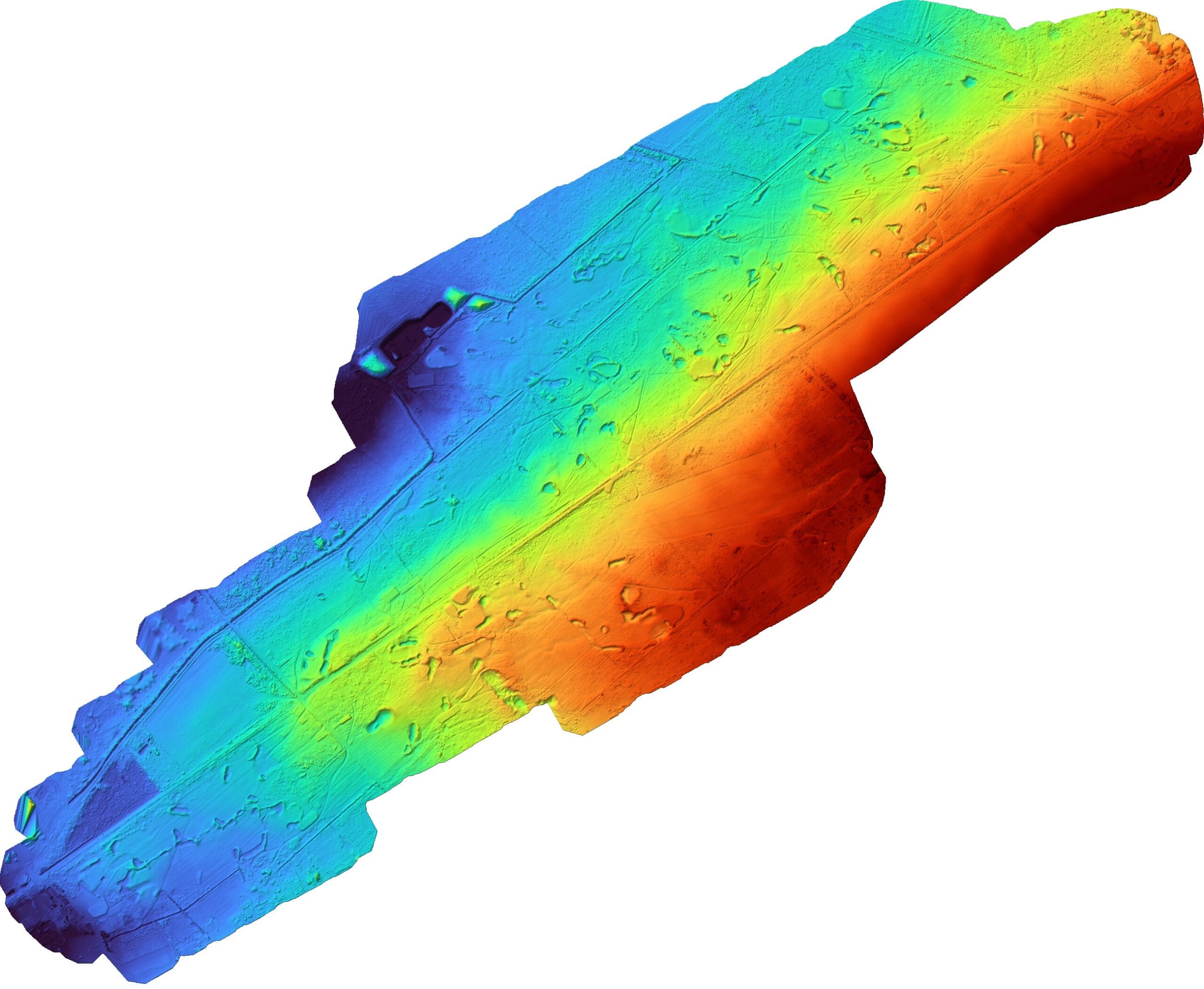
Hotchkin: a separate terrain model for the second course. Colours are display aids, not accuracy ratings.
04 / Checks and scope
A survey handover for the next stage of modelling
Both course packages were uploaded on 28 September 2026. Our contribution was the survey data and supporting reports for the client’s digital course-building workflow. Creating and releasing the finished simulation was the receiving team’s next stage.
Each course’s report accompanies the data and explains its survey checks and limitations. Image pixel size and terrain-grid spacing are not measures of positional accuracy.
05 / Project questions
What does a digital golf course need from a survey?
Why did this project need a DTM rather than a DSM?
A DTM represents the ground surface. A DSM also includes above-ground features such as tree canopies and buildings. The Woodhall Spa modeller needed ground heights for the digital terrain, so we supplied a bare-earth DTM and ground-classified points.
Can these files be used for an Unreal Engine golf course?
The handover was prepared for that workflow. The receiving modeller requested terrain and imagery that could be converted into an Unreal Engine heightmap. Sky Scan supplied GeoTIFF and LAZ survey files; the finished game environment was not part of our deliverable.
Why capture new data when existing LiDAR may be available?
The project team wanted data that reflected the courses they were recreating. Existing coverage can be useful, but its date, ground detail and extent need to match the brief. Our September 2026 survey supplied terrain and imagery from the same commission for both courses.
Planning a digital recreation of a real course?
Send the course boundary, the features your model needs to show, your software and your deadline. We can then agree the survey extent, terrain detail and file formats around your team’s next step.
Explore our drone survey services for aerial mapping and survey outputs.