Why Surveyors Are Turning to LiDAR Drones
As a professional in the surveying, engineering, or geospatial sector, you’ve likely faced at least one of the following issues:
- Struggling to access dense vegetation, steep slopes, or active construction zones
- Managing project deadlines with limited ground survey staff
- Being handed outdated or incomplete survey data and needing a fast refresh
- Needing more than just 2D plans — requiring actionable 3D intelligence for complex decisions
These are real-world constraints — and traditional surveying methods, while still important, aren’t always the most efficient solution.
Enter LiDAR drone surveys: a game-changing tool that combines speed, accuracy, and remote accessibility. At Sky Scan Surveys, we help UK professionals bridge the gap between technical surveying needs and modern delivery methods — without compromising data quality.
The Problem: Complex UK Terrain, Time Constraints & Risk
Let’s face it — no site is perfectly accessible. Whether you’re surveying a rail corridor, steep earthworks, a tree-covered site, or even protected archaeological land, there’s always something that gets in the way:
- Dense vegetation blocks line of sight
- Hazardous or uneven ground makes GNSS setups slow or risky
- Clients demand data “yesterday” — especially for planning submissions or infrastructure tendering
- Legacy data from five years ago isn’t cutting it anymore
In many cases, you’re stuck choosing between accuracy, speed, and safety. But with LiDAR drone technology, you don’t have to compromise.
The Solution: What LiDAR Drone Surveys Actually Solve
Access Issues Are Eliminated
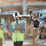
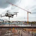
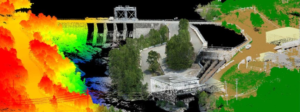
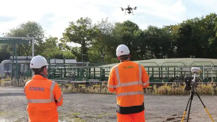
Whether you’re dealing with steep quarries, coastal cliffs, or live roads and railways, our CAA-certified drone pilots can survey them without needing boots on the ground. The airborne platform gives you full terrain coverage, even in hard-to-reach or dangerous zones.
Vegetation Is No Longer a Barrier
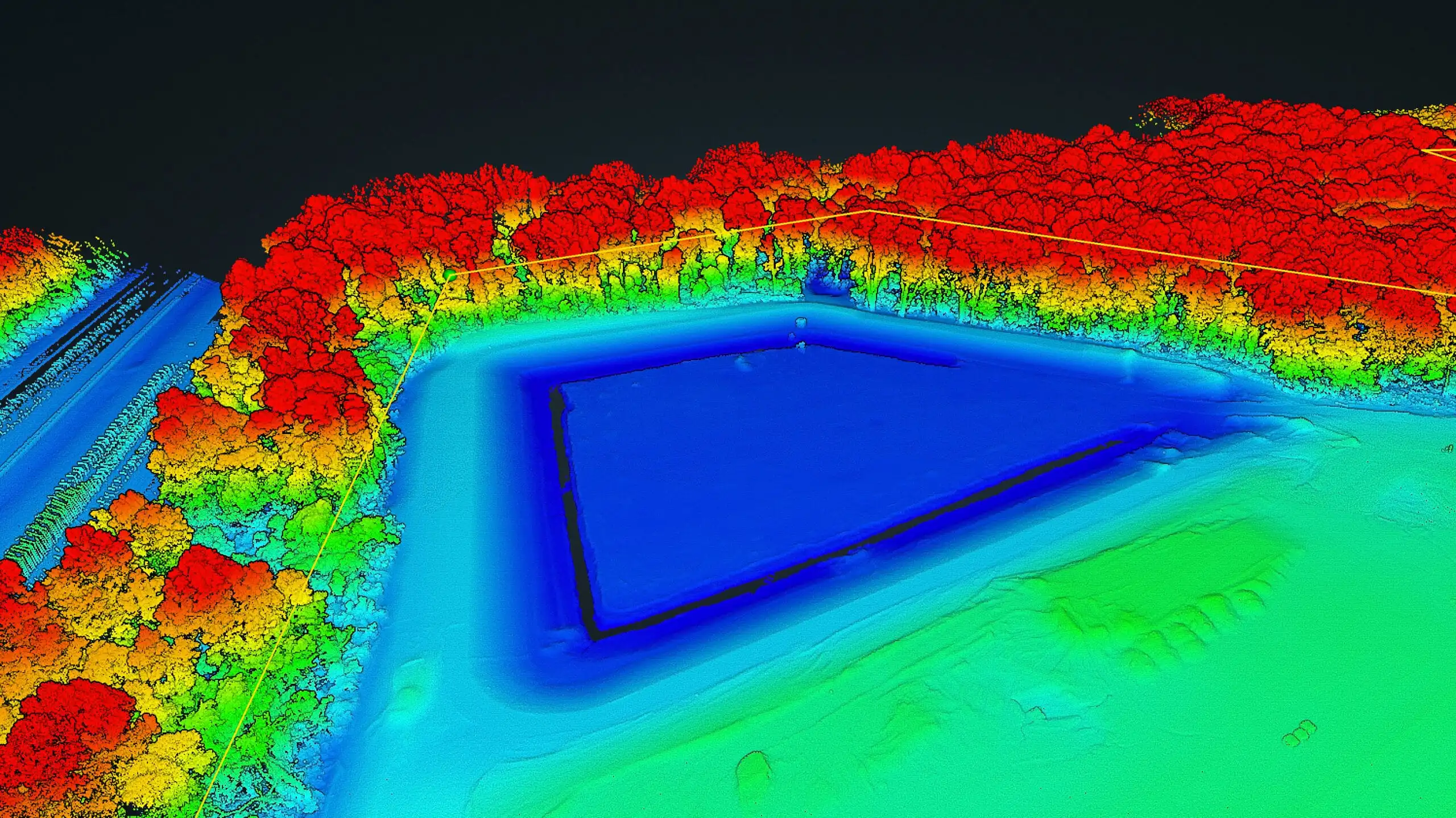
You Get Data in Days, Not Weeks
Because drones can map tens of hectares in under an hour, you reduce field time drastically. What used to take a week on-site now takes a day of drone flight, followed by precise post-processing from our in-house team. You stay ahead of schedule — and avoid holding up design or planning teams.
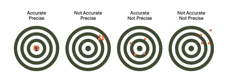
Accuracy That Meets Professional Standards
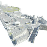
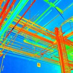
End Products You Can Actually Use
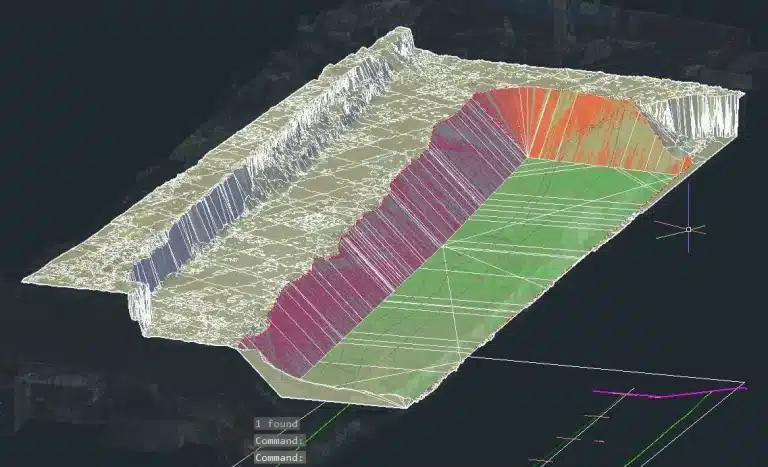
Whether you need point clouds, contour plans, cross-sections, or volumetric analysis — we process and package data in industry-standard formats that your team can plug directly into their workflow. No fluff, no filler — just usable data.
Use Cases Where Professionals See the Most ROI with LiDAR Drones
- Topographical Surveys for Planning or Earthworks
- Progress Mapping for Construction & Civils
- Volumetric Surveys for Stockpiles & Cut/Fill
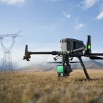
- Linear Route Mapping for Utilities & Rail
- Tree Surveys & Canopy Modelling for Arboriculture
- Flood Risk Mapping & Terrain Modelling for Drainage
Real Example: A Construction Site Bottleneck Resolved
A recent UK client was weeks behind due to a stalled ground survey in a heavily vegetated area adjacent to a live rail line. With access limited, and designers waiting, they brought in Sky Scan Surveys.
We deployed our LiDAR-equipped drone within 48 hours. In one flight, we mapped the entire site and surrounding slope zones, processed the data, and delivered DTM, DSM, and LAS files within three business days — accelerating their design stage and eliminating a costly delay.
Why Sky Scan Surveys Is a Trusted Partner to Professionals
- We’re surveying-focused, not just drone enthusiasts
- Our team understands what surveyors and civil engineers actually need
- We speak your language — from site benchmarks to CAD layering and engineering tolerances
- We deliver data fit for submission, not just pretty pictures
Final Thoughts: It’s Not Just About Drones — It’s About Solving Survey Problems
LiDAR drones are a tool — not a silver bullet. But in the hands of a qualified, experienced team like Sky Scan Surveys, they become a problem-solving asset. If you’re looking to eliminate bottlenecks, cover more ground in less time, and gain access to intelligent terrain data — now is the time to explore this technology.
Ready to Overcome Your Survey Challenges?
Let’s discuss your next project. Whether it’s terrain access, data delays, or vegetation interference, our LiDAR drone solutions are built to get you results faster and safer.