3D Laser Scanning for Buildings Cost UK
3D Laser Scanning for Buildings Cost UK (2025): The Complete Pricing Guide Navigating the costs associated with professional 3D laser scanning for buildings in the UK can seem complex. Unlike

3D Laser Scanning for Buildings Cost UK (2025): The Complete Pricing Guide Navigating the costs associated with professional 3D laser scanning for buildings in the UK can seem complex. Unlike
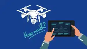
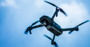
Drone Surveying Costs UK (2025): What You’ll Pay & How to Save Thinking of hiring a drone for a land survey, roof inspection, or construction mapping project? You’re not alone
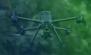
When you need accurate, fast, and efficient surveying, Sky Scan Surveys stands out as a trusted LiDAR drone survey company in the UK. Our cutting-edge LiDAR drone technology provides ultra-precise

A London architect recently saved an estimated £18,000 on a complex refurbishment project by investing just £4,200 in a precise measured building survey. This highlights a crucial point: while understanding
For surveying professionals across the UK, the challenges of traditional methods are often all too familiar. Whether it’s the time-consuming nature of traversing complex terrain, the frustration of line-of-sight limitations
Why Surveyors Are Turning to LiDAR Drones As a professional in the surveying, engineering, or geospatial sector, you’ve likely faced at least one of the following issues: Struggling to access
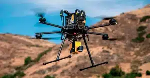
DJI has been a leader in the drone industry for years, and their latest offerings, the DJI Matrice 4T and DJI Matrice 4E, continue to set high standards for commercial

The aviation industry is undergoing a significant transformation, with drone aircraft technology leading the way. Unmanned Aerial Vehicles (UAVs), commonly known as drones, are revolutionising various sectors, including infrastructure inspection,

Drone videography has transformed the way we capture visuals, offering breathtaking perspectives that were once impossible without helicopters or expensive equipment. Whether you’re a filmmaker, real estate agent, or hobbyist,

Aerial videography has transformed the way we capture breathtaking landscapes, real estate footage, and even conduct essential inspections. Whether you’re a content creator, real estate professional, or surveyor, drone aircraft