Volumetric and Cut and Fill The Future of Construction
Accurate, Efficient, and Safe Site Surveys
Sky Scan Surveys is a leading innovator in construction and earthworks, utilising cutting-edge drone technology to boost efficiency, safety, and accuracy. Traditional methods often fall short in terms of speed, precision, and worker safety. Here at Sky Scan Surveys, we leverage drones to transform project management, delivering:
- Rapid data collection and precise measurements: Track progress, make informed decisions, and allocate resources effectively with real-time insights.
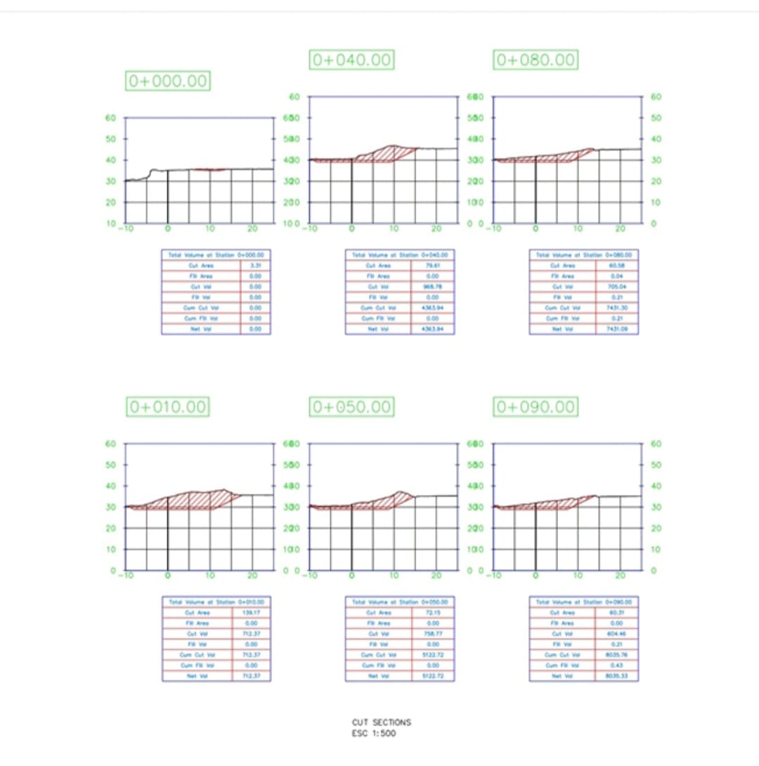
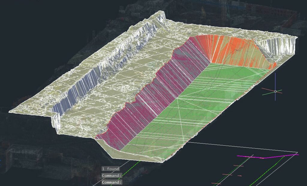
- Volumetric analysis: Gain accurate measurements of stockpiles, excavations, and earthworks, enabling precise calculations of cut and fill quantities.
- Reduced errors and costs: Eliminate manual measurement errors and minimise rework with highly accurate data, saving both time and money.
- Enhanced safety: Reduce risks associated with manual surveying by employing aerial data collection with drones.
- Frequent reports and topographic maps: Stay informed and on track with clear, actionable data presented in reports and detailed topographic maps.
From monitoring progress to calculating cut and fill volumes, Sky Scan Surveys is your partner in revolutionising construction and earthworks. Contact us today to see how we can transform your project!
Efficient, Accurate & Modern Solutions
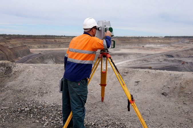
Traditional earthwork surveys are time-consuming, inaccurate, and unsafe.
Manual surveys can take days or even weeks to complete, and are prone to errors. This can lead to costly delays and rework.

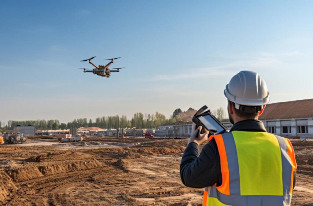
Drone earthworks surveys provide accurate and up-to-date data in a matter of hours. This data can be used to improve project management, reduce costs, and enhance safety.
cut and fill / volumetrics specialist

Get Started Today
We’re here to answer your questions and explore how our services can benefit your project. Don’t hesitate to reach out to us via phone, email, or through our social media channels.
Services & Features
Drone Earthworks Surveys
Stockpile Management
Cut & Fill Analysis
Progress Monitoring
As-built Documentation
Asset Inspection
Case Studies
Case Study
Montcliffe Quarry, Horwich, Greater Manchester
Challenge
The challenge at hand was to modernise quarry management while ensuring safety, particularly in the context of a hazardous cliff that made traditional surveying methods risky and inadequate. The quarry sought a solution to optimize operations and improve overall efficiency.
Solution
To address this challenge, the quarry adopted drone-based surveying techniques. This innovative approach aimed to conduct comprehensive aerial surveys of the quarry, covering various aspects such as assessing the cliff’s fall hazard, stockpile assessments, and grade plans. The primary objective was to enhance safety, efficiency, and data accuracy in quarry management.
Implementation
The transition to drone-based surveying was seamlessly executed. A significant advantage was the ability to launch the drones from a safe location, enabling surveys of the cliff and the entire site from up to 50 meters above ground. This transition was underpinned by three key aspects:
Drone earthworks surveys are a powerful tool for improving the efficiency, accuracy, and safety of construction projects. By using drones to collect data, construction companies can save time and money, reduce risks, and improve the quality of their projects.