Welcome to our blog! Today, we delve into the fascinating realm of Scan-to-BIM, an innovative process revolutionising the architecture, engineering, and construction (AEC) industry. At its core, Scan-to-BIM embodies the seamless conversion of physical spaces into meticulously detailed digital models, leveraging cutting-edge technologies like 3D laser scanning and advanced software solutions. Join us as we uncover the intricacies of this transformative methodology and explore its myriad applications across various sectors.
Understanding Scan-to-BIM
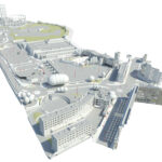
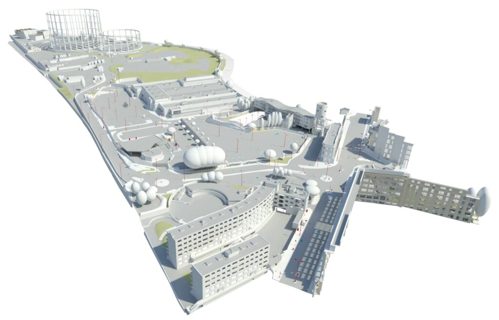
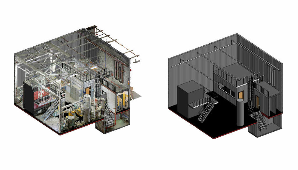
Scan-to-BIM, or Building Information Modelling, encapsulates a sophisticated approach utilised by AEC professionals to create comprehensive digital representations of real-world structures. This process involves capturing millions of data points per second using state-of-the-art 3D laser scanners, thereby generating precise point clouds that faithfully replicate the physical environment.
The Scanning Process Unveiled
Before embarking on the scanning journey, meticulous planning is paramount. Factors such as scan purpose and desired level of detail dictate the scanning strategy, influencing the number and location of scans required. Once planning is complete, the scanning phase commences, wherein the 3D laser scanner meticulously captures the spatial nuances of the target area. Multiple scans from various vantage points may be necessary to ensure comprehensive coverage, especially for large or intricate spaces.
Navigating Data Processing
Following the scanning endeavour, the amassed data is meticulously processed to unlock its full potential. Specialised software is employed to calibrate and register the raw scan data, ensuring optimal accuracy and compatibility with BIM platforms. This calibrated data serves as the foundation for creating immersive digital models that can be seamlessly integrated into the design and planning phase.
Unveiling the Benefits of Scan-to-BIM:
The advantages of Scan-to-BIM are manifold, offering a paradigm shift in how AEC projects are conceptualised, executed, and managed:
- Unparalleled Accuracy and Efficiency: 3D laser scanning delivers unrivalled precision and expediency, surpassing traditional surveying methodologies.
- Error Reduction: By minimising human intervention, Scan-to-BIM mitigates errors and streamlines data collection processes.
- Informed Decision-Making: Digital models facilitate informed design decisions, enabling stakeholders to visualise and iterate designs with unprecedented clarity.
- Versatility Beyond AEC: Scan-to-BIM transcends its architectural roots, finding applications in diverse domains such as forensics, where it aids in documenting crime scenes with forensic precision.
Exploring Real-World Applications
From architectural revitalisations to infrastructure upgrades, Scan-to-BIM is at the forefront of modernising the built environment. Whether it’s retrofitting historical landmarks or optimising industrial facilities, the versatility of Scan-to-BIM knows no bounds.
Read More: Drone in War: Transfer Modern Ware
Conclusion
In essence, Scan-to-BIM heralds a new era of digital transformation in the AEC landscape, empowering professionals to reimagine spaces with unparalleled precision and efficiency. As technology continues to evolve, the potential of Scan-to-BIM to revolutionise the way we design, construct, and manage our built environment is limitless.
Stay tuned for more insights, trends, and innovations shaping the future of architecture, engineering, and construction. Join us on this exciting journey as we unravel the boundless possibilities of Scan-to-BIM!