Sky Scan Surveys provides a range of surveying services, throughout the UK. Our dedicated team conducts each survey with professionalism ensuring we maintain standards for all clients regardless of project size or location.
Our surveyors are skilled, experienced and insured offering geomatic services using cutting edge equipment and technology. We approach each project with flexibility and expertise utilizing detailed survey techniques to produce drawings and floor plans.
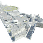
A measured building survey involves capturing measurements of buildings and sites to create scaled data representations.
With technology advancements like drones, these surveys can now be conducted with precision. The outputs can range from ground floor plans to detailed 3D models based on the projects requirements.
What is Involved in a Measured Building Survey?
Every project comes with its set of requirements such, as the scale needed accuracy levels, level of detail, timeframes for delivery and associated costs. The data gathered serves as the groundwork for planning stages like space allocation and fire safety measures forming the basis for all development and design blueprints to make the real spaces into digital realities.
It is essential to conduct surveys before creating any schematics to prevent issues like cost escalations, project delays and non compliance with planning regulations and building codes. Accurate surveys play a role in averting problems such as construction or surpassing height restrictions that could result in legal complications.

How is a Measured Survey Carried Out?
Our expert surveyors employ cutting edge tools to ensure precision. Prior to commencing the survey they review existing site data like Google Maps to grasp the site layout and its surroundings. Modern laser technologies complement measurement methods, enabling accurate data acquisition. For example laser tape measures can accurately measure distances up to 200 meters with a precision of 2 millimeters thereby reducing delays, disputes and additional expenses with a drone is its 20 millimeters.
Measured Surveys Catering, to Diverse Clients
We offer services regularly to landowners, developers, construction firms, architects, planning specialists,
project managers,
engineers,
and other professionals involved in planning.
Surveying plays a role, in ensuring project planning and development by offering thorough representations of land and structures.
To explore more about the costs and options for our surveying services reach out to Sky Scan Surveys for a solution customized to your budget and survey requirements. Our dedication to delivering notch, practical and innovative services guarantees that we cater to the needs of each project.
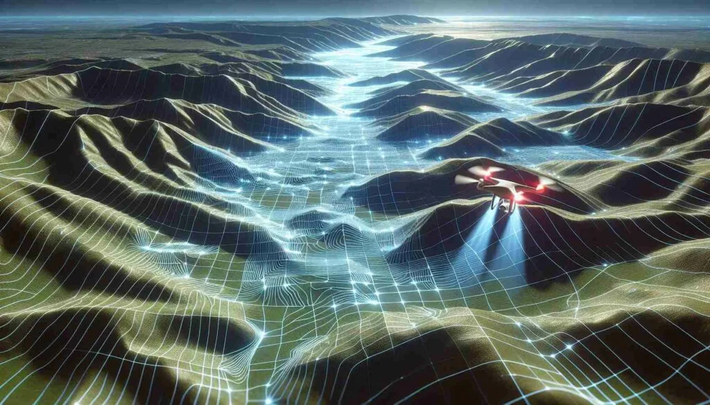
Topographic Surveys
A topographic survey presents a portrayal of a project site highlighting variations in land elevations and slopes. These surveys. Map the contours of the terrain well as existing features above and below ground level. Elements like trees, buildings, roads, walkways, grids, manholes, retaining walls and utility poles are all encompassed.
Topographic surveys are tailored to meet project demands with specifications or guidelines provided by clients. Using software we create plans relative to land coordinates existing reference points or OS grid system coordinates including elevations, contours, site features GPS data points and cross sections. The finalized drawings are delivered in format or hard copies along with.dwg files.
Building Surveys
Whether its, for renovations, modifications or extensions or replicating existing design details; we offer accurate plans detailing the architectural and structural aspects of buildings.
Our flexible approach ensures that we meet each clients needs with precision enabling planning and design.
Accurate surveys play a role, in ensuring project efficiency sticking to budgets and meeting deadlines.
Mapping Underground Utilities
We can create a survey drawing or utilize a land survey plan provided by the client as a base layer for mapping existing utilities and underground services. By employing electromagnetic and Ground Penetrating Radar (GPR) systems we achieve service mapping with accuracy. We also integrate utility record search data for land utility mapping presented in.pdf and.dwg formats using AutoCAD.
Dedication to Quality and Innovation
At Sky Scan Surveys we are committed to delivering top notch, practical and dependable project solutions through innovative techniques and approaches. Our unwavering high standards ensure client satisfaction, across sectors and industries.
Costs of Measured Building Surveys
The cost of a building survey varies based on the scope of work involved. Larger buildings may require floor plans impacting the overall cost. Reach out to us today for a quote. Discover how we can tailor our survey services to fit your budget.