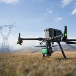
In today’s construction industry, efficiency and precision are paramount. Traditional methods of monitoring progress can be time-consuming, costly, and even dangerous. Enter drone surveys, a revolutionary technology transforming how we track construction progress across the UK.
Why Drone Surveys are the Best Approach
- Unmatched Efficiency: Drones capture vast areas of a construction site in a single flight, minimising disruption to ongoing operations. Traditional methods like manual surveying or scaffolding can be far slower and more labour-intensive.
- Enhanced Safety: Drone surveys eliminate the need for personnel to access hazardous areas or climb tall structures. This translates to a safer working environment for everyone on the building site.
- Detailed Data Capture: High-resolution cameras and advanced sensors on drones provide intricate details of the construction site. This translates to precise measurements and 3D models for accurate progress tracking.
- Accessibility Made Easy: Drones can reach previously inaccessible areas like steep slopes, deep excavations, or complex structures. This provides a comprehensive picture of the entire building site.
- Cost-Effectiveness: In many cases, drone surveys can be more cost-effective than traditional methods. The time saved, combined with the improved safety and data quality, makes drones a valuable investment.

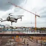
Mapping Progress with Drone Surveys
Drone surveys offer a multitude of benefits for mapping construction progress:
- Track Excavation and Backfilling: Accurately measure excavated volumes and monitor progress on backfilling operations.
- Monitor Foundation Work: Ensure precise foundation layout and track concrete pouring progress.
- Visualise Framing and Structural Work: Gain a clear understanding of the construction progress for walls, beams, and columns.
- Track Cladding and Roofing: Monitor the installation of external walls, roofing materials, and track overall building envelope progress.
- Volume Calculations: Precisely calculate stockpiles of materials like soil, gravel, or concrete for efficient inventory management.
- Beyond the Snapshot: Advantages of Ongoing Drone Surveys
Regular drone surveys throughout the construction project offer significant advantages:
- Identify Potential Issues Early: Regular data capture allows for early detection of deviations from the construction plan, enabling swift corrective actions.
Improved - Communication and Collaboration: 3D models and progress reports generated from drone data can be easily shared with stakeholders, fostering better communication and collaboration.
- Enhanced Project Management: Drone data empowers project managers to make informed decisions based on accurate progress tracking and site visualisation.
Taking Your Construction Project to New Heights
Drone surveys are no longer a futuristic concept; they are a powerful tool shaping the present and future of construction site monitoring in the UK. By incorporating drone surveys into your project management strategy, you gain a bird’s-eye view of progress, improve safety, and make data-driven decisions that propel your construction project forward.
Ready to explore how drone surveys can revolutionise your construction project? Contact us today to discuss your specific needs!