

Land surveying is a vital process in property development, real estate transactions, and land management. It involves the accurate measurement and mapping of a plot of land to determine its boundaries, size, and topography. Whether you are buying land, planning construction, or involved in land disputes, a land survey is a critical step that ensures legal protection and precision in planning.
In this guide, we’ll explore what a land survey includes, the types of surveys you might need, and why hiring a professional land surveyor is essential for your project.
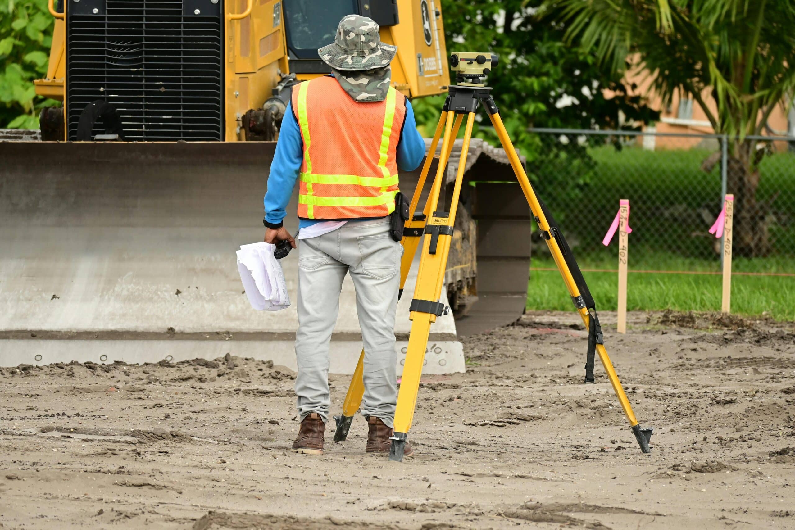
What is a Land Survey?
A land survey is the process of measuring and mapping the dimensions and characteristics of a piece of land. Professional surveyors use a combination of modern technology and traditional methods to determine the boundaries, topography, and features of the land. This includes the identification of natural features like trees and water bodies, and man-made structures such as roads, buildings, and fences.
Typically, a land survey will cover:
- Boundary lines: To establish legal property boundaries.
- Topographical features: Including elevation, trees, roads, and other physical attributes of the land.
- Soil quality: Sometimes included, particularly in construction projects to assess ground conditions.
Surveyors use specialised tools such as total stations, global navigation satellite systems (GNSS), and laser scanning technologies to ensure precise measurements and comprehensive results.
Types of Land Surveys and Their Importance
There are several types of land surveys, each suited to specific needs and purposes. Below are the most common types:
1. Boundary Survey
A boundary survey is one of the most commonly required types of land surveys. It is conducted to determine the exact boundaries of a property, which is essential for resolving property disputes, establishing new boundaries, or before selling or buying land.
• Why it’s important: Prevents disputes with neighbours and clarifies the legal extent of your property.
• What’s included: Researching historical property records, marking out boundary lines, and identifying any encroachments or easements.
2. Topographic Survey
A topographic survey is used to map the surface features of a piece of land, including both natural features like hills and rivers, and man-made structures such as buildings and roads.
• Why it’s important: Essential for architects, engineers, and developers to understand the physical layout of the land when planning construction or development.
• What’s included: Elevation data, contour mapping, and the location of all visible physical features.
3. Detailed Survey
A detailed survey involves an in-depth analysis of a plot of land, capturing highly detailed 3D images and data about the land’s topography, soil composition, and sometimes even video footage.
• Why it’s important: Provides an extremely detailed and accurate representation of the land, useful for major construction projects or extensive land development.
• What’s included: 3D imaging, soil tests, and data on the exact layout of the land.
4. Construction Survey
A construction survey focuses on ensuring that a plot of land is suitable for building. It helps contractors and architects stake out the property, defining key markers and points that will be essential for construction.
• Why it’s important: Ensures the construction will proceed in the right location and with the right foundation.
• What’s included: Marker placement, alignment checks, and staking out critical infrastructure points.
5. Soil Survey
A soil survey is often part of a detailed survey and assesses the quality and composition of the soil. This survey is crucial for any construction project to ensure that the land can support the weight of a building.
• Why it’s important: Helps avoid costly mistakes by identifying soil conditions such as contamination, or whether the soil will support foundation structures.
• What’s included: Soil sampling, pH levels, contamination testing, and soil composition analysis.
Why Do You Need a Land Survey?

A land survey is essential for many reasons, whether you are buying, selling, developing, or resolving disputes. Here are some key reasons why land surveys are needed:
1. Establishing Boundaries
A land survey is crucial for establishing property boundaries, whether you’re purchasing land or settling a dispute with neighbours. Accurate boundary lines prevent future legal conflicts and ensure that construction or development is done within legal property limits.
2. Planning and Construction
For property developers, a land survey provides crucial information that aids in construction planning. From topographical features to soil conditions, having a survey allows you to design more accurately and ensures the project stays on budget and on schedule.
3. Obtaining Planning Permission
When applying for planning permission from local authorities, a land survey is typically required to show the exact location and boundaries of the proposed development site. This ensures compliance with zoning laws and other regulatory requirements.
4. Assessing Property for Sale or Purchase
Whether you are buying or selling a property, having a land survey completed gives you confidence that the land is suitable for your needs. It also provides reassurance to buyers and lenders that the property’s boundaries are clear and that there are no hidden issues.
What Does a Land Survey Cost?
The cost of a land survey varies depending on factors such as the size of the land, location, and the complexity of the survey required. On average, land surveys can range from £300 to £1,000. Here are some factors that affect the price:
- Type of survey required: Boundary surveys are usually less expensive than detailed topographic or construction surveys.
- Land size: Larger properties will cost more to survey.
- Urgency: Faster turnarounds may incur higher costs.
- Location: Properties in remote or difficult-to-access areas can also increase the cost.
Hiring a Professional Land Surveyor
While it’s tempting to attempt a DIY land survey, hiring a professional surveyor is essential to avoid costly mistakes and legal complications. Professional surveyors are trained and certified to use the latest equipment and techniques to ensure accuracy.
- Why hire a professional: Land surveyors are skilled at interpreting data, using complex tools, and adhering to legal requirements. Attempting your own survey can lead to errors that may cause problems down the line, especially in boundary disputes.
Conclusion
A land survey is essential for anyone involved in land ownership, property development, or construction in the UK. Whether you’re planning a new build, buying property, or resolving a boundary dispute, having a land survey provides the necessary information to make informed decisions.
Sky Scan Surveys offers professional land surveying services across the UK, using the latest technology and experienced surveyors to ensure the accuracy and efficiency of your project.
Get in touch today to learn more about our land survey services and how we can help with your next project!